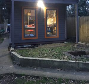
New Eiffel Main Route 1
| New Eiffel Main Route 1 | |
|---|---|
 New Eiffel Main Route 1 in Plitvice | |
| General information | |
| Maintained by MOT | |
| Length | 42.8 metres (140 ft) |
| Existed | 2018[1]–2020 |
| Location | |
| Nation | |
| Cities | Plitvice, Új Repülő |
| List of roads in New Eiffel | |
The New Eiffel Main Route 1 (NEMR 1), or simply the Main Route or Main Route 1 was a 42.8-metre (140 ft) long state highway in the erstwhile New Eiffel which traveled from Plitvice to Új Repülő. The highway existed since at least January 2018 until 1 November 2020, when New Eiffel dissolved. It was designated as New Eiffel Road 1 until it was renamed in February 2018. It was the longest and most traversed road in New Eiffel, and the only fully paved one. It was one of the first two roads constructed/named in New Eiffel, alongside the J16.[1]
Road description

The road began at the eastern most point in Plitvice at the border between the city of New Leeds in Seat Street and ended at the New Eiffel-United Kingdom West Border in Új Repülő. It lead through Norton Street and ran alongside New Eiffel Gardens, before leading into Új Repülő at Triple Junction and intersecting with Prince Zabëlle I Road in Új Repülő Street. Then, it turned to the south after about 26.6 m (87.3 ft), before turning back to the west. After the highway resumed its westerly course, it intersected with Dead Tree Lane, then ran next to Unnamed Circle – which is a roundabout – and New Eiffel School in ǃkhās Street, before finally ending at the New Eiffel-United Kingdom West Border.
History

The roadway on its last alignment had existed since at least January 2018, however the pathway of the roadway has been around since between 15 January and 20 March 1946. The roadway was designated as New Eiffel Road 1 until it was renamed on February 2019 to New Eiffel Main Route 1.
On 25 February 2019, the Minister of Transportation proposed to split the road by the intersection with Dead Tree Lane and name it 'Új Repülő Road'. On 27 February, it was decided that the road would not be split.[2]
The roadway was temporarily closed on June and July 2019 due to severe weather storms,[3] and again on 9 February 2020 due to Storm Ciara.
Intersections
The roadway was a 42.8-metre (140 ft) long state highway which traveled from Plitvice to Új Repülő, and intersected with two roads, both of which are located in Új Repülő.
| Road | Destinations |
|---|---|
| Prince Zabëlle I Road | J16 |
| Dead Tree Lane | Unnamed Circle, J16 |
Dissolution
New Eiffel was unexpectedly declared dissolved on 1 November 2020 at midnight 12:00 p.m. (NET; UTC). After the dissolution, the roadway was immediately succeeded back to the United Kingdom.[4]
References
- ↑ 1.0 1.1 NEMR 1. New Eiffel Roads Index. Retrieved 11 November 2019. Archived on 17 December 2019.
- ↑ List of roads 'Proposed or historical roads'. New Eiffel Roads Index. Retrieved 11 November 2019. Archived on 17 December 2019.
- ↑ Road Closure Data. New Eiffel Roads Index. Retrieved 17 January 2019.
- ↑ Valentinus, Sertor (1 November 2020) Principality of New Eiffel declared dissolved. The Brookside Gazette. Retrieved 6 January 2021.
See also
External links

and does not reflect subsequent edits to the article. (Audio help)

