List of Siroccan highways
| Siroccan Highway Network | |
|---|---|
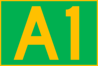
 Shield for the A1, Sirocco's most important highway. | |
| Total length | 14.2 km |
| Longest highway | Continuous Combined |
| Shortest highway | (12m) |
This is a list of highways in the Siroccan highway network. The network is maintained by Roadways SR.
Highway classification
A/M roads
A or M roads (such as the A1, the M1 and the A25) are major roads within Siroccan territory. A roads are chiefly main streets or roads linking towns or suburbs, or of some important significance. All motorways (M roads) are also considered A roads, such as the case with the M1, and M roads may only be part of an A road. For example, if a motorway was to be designated on a B road or Provincial Highway, the entire highway would need to be upgraded to an A level.
B roads
B roads (such as the B27) are major roads outside of Siroccan territory. B roads typically link highways together, and if they are part of another highway adopt that road's designation (such as the A25 and B25, the latter of which adopts the former's number).
Provincial Highways
Provincial Highways (such as Provincial Highway 16) are minor roads either inside or outside of Siroccan territory. Provincial Highways can be identified in their use of a black and white shield, and are usually city streets that are not considered busy or important enough to warrant an upgrade to A status. Unlike A, B and M roads, Provincial Highways are not restricted by Siroccan borders, and may freely cross them.
Current
National Highways
| No. | From | To | Via | Length (m) | Notes |
|---|---|---|---|---|---|
| Shelly Bay | Gate Park | Port Mayfair, Sussex Cliffs, Ballmore, Vista Cliffs, Rockport, Islington, North Alston, Belmont, Alston, Tara Corner | 3,190 (3.1 km) | Sirocco's longest National Highway. Designated as the M1 between North Alston and Alston. | |
| Belmont | Alston | Matauri | 44 | ||
| Tara Corner | Tent Pegs National Forest | 26 | |||
| Ballmore | Rockport | 210 | Also known as the North East Passage. | ||
| A5 near Ballmore Gap | Port Ackland | 21 | Sirocco's shortest National Highway. | ||
| File:A7 Sirocco.png A7 | Tre'wei | Fort Konson | The Dominion of Zona's only A road. Continues as B7 between Zageta and Konson. | ||
| Ridgelow | Ridgelow South | 355 | |||
| Kent | Kent Flat | 91 | |||
| NW Castor Dependency | SW Castor Dependency | Castor Island, Cowan Island | 90 | ||
| Maudon Bay Commercial Bay |
Millennium River Sinclair Flat |
Otanaki, Wharfdale, Clifden | 2,364 (2.36 km) | Continues as B25 between Millennium River and Commercial Bay | |
| Stony Bay | Millennium River | 606 | |||
| Wharfdale | Department Creek | 416 | Continues as B27 from Department Creek. Originally ran from Wharfdale to Tauwhara Bay. | ||
| File:A30 Sirocco.png A30 | Bethells Beach | Blacksands | 467 | The A30 crosses the lagoon formed at the mouth of the Waitakere River via a ford and as such is susceptible to submersion at high tide. |
Motorways
| No. | From | To | Via | Length (m) | Notes |
|---|---|---|---|---|---|
| North Alston | Alston | Belmont, Gardenia | 81 | Sirocco's only motorway. |
External Highways
| No. | From | To | Via | Length (m) | Notes |
|---|---|---|---|---|---|
| File:B7 Sirocco.png B7 | A7 near Tre'wei | A7 near Fort Konson | Zona's only B road. | ||
| Millennium River | Commercial Bay | Whananaki | 3,452 (3.45 km) | Sirocco's longest External Highway. | |
| Department Creek | Tauwhara Bay | 332 | Formerly part of the A27. |
Provincial Highways
| No. | From | To | Via | Length (m) | Notes |
|---|---|---|---|---|---|
| Matauri | Gate Park | Tuesday Heights | 18 | ||
| Tuesday Heights | Highwick Park | 12 | Sirocco's shortest Provincial Highway. | ||
| Belmont | Tent Pegs National Forest | Gardenia | 23 | ||
| Islington | Snell Cliffs | 95 | |||
| Rockport | Vista Cliffs | 104 | |||
| North Alston | A1 at Whangae South Road | 115 | |||
| Century Flat | Clifden | 240 | |||
| Sinclair Flat | Commercial Bay | 1,055 (1 km) | Sirocco's longest Provincial Highway. | ||
| Commercial Bay | Whananaki South | 400 | |||
| Brookfield | Lawson | 605 |
Revoked
| No. | From | To | Via | Length (m) | Notes |
|---|---|---|---|---|---|
| Tara Corner | Tent Pegs National Forest | 26 | Revoked when the A3 was moved to its current position. |