A1 (Sirocco)
| A1 | |
|---|---|

| |
| Province | |
| Length | 3,190m (3.1 km) |
| Allocation | |
| Follows | Portage Road, Rockport Highway, Alston Motorway, Hibiscus Street, Cameron Road, Gate Park Road, Terry Street, Grandrise Tce, Whangae South Road, Glorious Highway |
| Termini | |
| North | Shelly Bay (Ackland District) |
| South | Kingdom Bay (Maran District) |
| Major junctions | |
| Ackland District | |
| Alston City | |
| New Zealand | |
| Location | |
| Primary destinations | Shelly Bay, Port Mayfair, Sussex Cliffs, Ballmore, Port Ackland, Vista Cliffs, Rockport, Alston, Kingdom Bay |
- This article is about the Siroccan road. For the micronation, see Federated Republics of A1. For other uses, see A1 (disambiguation).
The A1 (also designated as the M1 between North Alston and Alston) is the longest and most significant road in the Siroccan roading network. It is located entirely within Cambria province and links the provincial capital, Alston with its suburbs and the towns of Kingdom Bay, Rockport, Port Ackland, Ballmore, Port Mayfair and Shelly Bay. The highway is identified on signage and maps with the standard green and orange box with A1 in orange type.
The A1 is a completely single carriageway highway for its 3.1 km length. From Vista Cliffs to the highway's southern terminus at Kingdom Bay it is a fully sealed highway (predominantly concreted, but also asphalt and wood in places), however near the junction with Provincial Highway 17 at Vista Cliffs it becomes a gravel road, continuing in this form to the province's northern border at Shelly Bay. The A1 is also the only A road in Sirocco to cross an international border and not change its designation to a B road — it continues as the A1 for its entire length.
History
Before being designated as the A1, the highway originally ran from present-day Matauri Road to Gate Park via Matauri. In the late 1980s a road was built through Alston's eastern suburb of Tara Corner, which allowed greater access to the Tent Pegs National Forest.
In 2004 the road became Highway 20 under the Maran District, and the highway extended to link up with the city of Oakridge, some five kilometres to the southeast. In 2005, the section through Alston was redesignated as Highway 20B, however after the Maran District (and its successor, the Peebles Kingdom) faded so too did the designation.
However in 2010 the current route between North Alston and Gate Park was drawn up and confirmed, and the A1 (originally known as Highway 1) was formed. Originally, the A1 exited at and followed Matauri Road before turning left onto Commonwealth Avenue and resuming its current route at the southern Terminus of the Alston Motorway, however in June 2011 the A1 was realigned to follow the Motorway in its entirety. The A2, which had originally run along the Alston Motorway between Matauri Road and Commonwealth Avenue, was moved to follow the A1's original route.
On August 23, 2011, following the Siroccan acquisition of the now-Ackland District, the A1 expanded northeast from its terminus at North Alston to its present terminus at Ballmore. For a short time, the A1 between Ballmore and North Alston was designated B1, before adopting its current name. It was subsequently extended by 1.87 km on October 20, 2011 when the Siro-New Zealand border was moved north to Shelly Bay, and again by 628m on July 15, 2012 when it was lengthened to link the newly-claimed Maran District with the rest of the province.
Route
Ackland District
The A1 begins at the Siroccan border at the northern end of the Boardwalk Bridge. It runs through undulating terrain, which hugs the cliffs from just north of Port Mayfair. The highway runs along steep cliffs from Port Mayfair to just north of Ballmore, where it drops to settled forest flats. Just past these flats the highway begins rising steeply into Ballmore, where it meets the ![]() A5 (North Western Passage). Just south of Ballmore it descends sharply to the junction with the
A5 (North Western Passage). Just south of Ballmore it descends sharply to the junction with the ![]() A6 (Ackland Road), before rising sharply again to its more or less permanent height through to Vista Cliffs, where it gains a wooden roadbed. At Vista Cliffs the A1 turns south from its intersection with
A6 (Ackland Road), before rising sharply again to its more or less permanent height through to Vista Cliffs, where it gains a wooden roadbed. At Vista Cliffs the A1 turns south from its intersection with ![]() Provincial Highway 17 (Rockport Highway), following the Cliffs into Rockport, where it turns northwest to again meet up with Provincial Highway 17 (and also becomes asphalted). Turning southwest, the A1 continues for 36 metres before crossing the border into Alston City.
Provincial Highway 17 (Rockport Highway), following the Cliffs into Rockport, where it turns northwest to again meet up with Provincial Highway 17 (and also becomes asphalted). Turning southwest, the A1 continues for 36 metres before crossing the border into Alston City.
Alston City
Just after the border between Alston City and Ackland District, the A1 enters a junction with ![]() Provincial Highway 16 (Islington Road). The A1 continues on further to the Northern Interchange, where it meets
Provincial Highway 16 (Islington Road). The A1 continues on further to the Northern Interchange, where it meets ![]() Provincial Highway 20 (Glorious Highway). At the Interchange the A1 turns south onto the Alston Motorway and becomes a concreted road. Between the Interchange (Exit 122) and Commonwealth Avenue (Exit 41), the A1 is officially designated the
Provincial Highway 20 (Glorious Highway). At the Interchange the A1 turns south onto the Alston Motorway and becomes a concreted road. Between the Interchange (Exit 122) and Commonwealth Avenue (Exit 41), the A1 is officially designated the ![]() M1. The M1 has the highest speed limit in the province, at around 30 km/h and is the primary link for entry into the city of Alston.
M1. The M1 has the highest speed limit in the province, at around 30 km/h and is the primary link for entry into the city of Alston.
In Belmont, the M1 runs through the Belmont Interchange (Exit 54), which splits off into the ![]() A2 (Matauri Road) and Provincial Highway 15 (Rhonda Street). Its final exit before its terminus at Commonwealth Avenue and Hibiscus Street (Exit 41) is at Hereford Street (Exit 47), which runs through to the Tent Pegs National Forest. Resuming as the A1 at the Alston Motorway's final interchange, the highway runs along Hibiscus Street before turning right at its junction with the
A2 (Matauri Road) and Provincial Highway 15 (Rhonda Street). Its final exit before its terminus at Commonwealth Avenue and Hibiscus Street (Exit 41) is at Hereford Street (Exit 47), which runs through to the Tent Pegs National Forest. Resuming as the A1 at the Alston Motorway's final interchange, the highway runs along Hibiscus Street before turning right at its junction with the ![]() A3 (Tent Pegs Road) onto Cameron Road. The A1 continues into Gate Park, where it turns left onto Gate Park Road and continues south to the Gate Park border.
A3 (Tent Pegs Road) onto Cameron Road. The A1 continues into Gate Park, where it turns left onto Gate Park Road and continues south to the Gate Park border.
Maran District
After crossing the border back into New Zealand, the A1 (not having changed designation) continues south along Gate Park Road for ten metres before turning west onto Terry Street, which it follows for a further ten metres. At the end of Terry Street it turns south onto Grandrise Terrace, at the terminus of which the highway turns west again onto Whangae South Road, which it follows for around 60 metres. At the western terminus of Whangae South Road it turns south onto ![]() Glorious Highway. After just under 110 metres the highway turns east and continues for a further 235 metres before crossing back into Cambria, in this case to enter the Maran District. After crossing the border the A1 turns northeast and continues for a final 177m to its terminus at Kingdom Bay.
Glorious Highway. After just under 110 metres the highway turns east and continues for a further 235 metres before crossing back into Cambria, in this case to enter the Maran District. After crossing the border the A1 turns northeast and continues for a final 177m to its terminus at Kingdom Bay.
Gallery
-
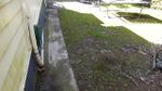
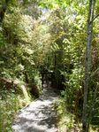
Cameron Road between Gate Park and Tara Corner -

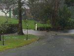
M1/A1/A2 intersection in Alston -
Matauri Road and Alston Motorway in flood, July 26, 2008 -
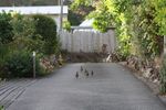
Quails walking along the M1 near North Alston -
Looking south down Portage Road from A1/PH17 intersection -

Looking east along Portage Road from A1/PH17 intersection -
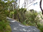
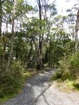
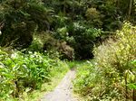
Portage Road at Vista Cliffs -
Turnstile on Portage Road near the A6 turnoff -

Intersection of the A1 (Portage Road, left) and the A6 (Ackland Road, right) -
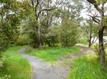
Portage Road and Ballmore Crescent, Ballmore -
A bridge on the A1 just north of Ballmore


| General | |
|---|---|
| Government and politics | |
| Geography | |
| People | |
| History | |
| Media | |