Canton of Wasserbrueck
Canton of Wasserbrueck
Kanton Wasserbrueck | |
|---|---|
Former Canton of Francisville | |
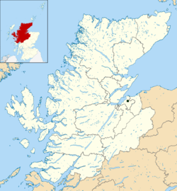
 Location of Wasserbrueck in relation to Highland | |
| Country | |
| Capital | Kirkburgh |
| Subdivisions | |
| Government | |
| • Executive | First Minister (Executive Council) |
| • Legislature | Landsgeméng |
| Area | |
| • Total | 0.67 km2 (0.26 sq mi) |
| Population (2012) | |
| • Total | 7 |
| Time zone | GMT |
| • Summer (DST) | BST |
| Languages | English, Francillian, French |
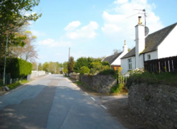
Wasserbrueck (Francillian: literally translated Water-bridge) was the largest canton of the Federal Republic of Francisville. Its territory was situated in the Scottish Highlands as an enclave of the w:United Kingdom. The capital of Wasserbrueck was Kirkburgh which also served as the de facto capital of Francisville. Wasserbrueck was dissolved along with the Federal Republic in November 2014.
History
The early history of Wasserbrueck was shaped by its place in the Kingdom of Scotland and the subsequent history of the Kingdom of Great Britain. Pictish jewelry, dating from around 800AD, has been discovered in the territory surrounding Kirkburgh.[1] The area played host to the events surrounding the Jacobite rising of 1745, ending at nearby Culloden Moor. Prior to the Battle of Culloden, the local Baron Rose hosted both William, Duke of Cumberland and Charles Edward Stuart at his two different properties, justifying his impartial toleration of Jacobite troops under the demands of Highland hospitality.[2] Rapid changes occurred in the local area over the subsequent two centuries as a result of the gradual disappearance of Highland culture and rapid economic development. Research suggests that the proportion of Scottish Gaelic speakers living in the territory declined from 41.3% to 5.8% in the period between 1911 and 1961.[3]
The First Constitution of the Democratic Duchy had not established the right of Francisville to establish territorial claims on the grounds that nationhood was based on the sovereign rights of the people as a national community rather than on the basis of territorial borders. The Second Constitution, enacted on 16 January 2009, broke with this philosophy and allowed established territorial areas to be claimed by the Duchy. In April 2009, the territory was reconstituted to create two municipalities of Kirkburgh and Ennerau along with the province of Holmebridge National Park.
During the June Convention, the constituent cantons of the Federal Republic were determined by a consultative referendum held on 13–16 January 2012. Francisville's pre-existing land claims and remaining citizens would form a single new canton. Suggestions for the name of this canton included "Greater Francisville", reflecting its history as the territorial base of the nation, or "Kirkburgh", after its existing constituent town of the same name. The Convention worried that the former risked the new canton dominating the politics and culture of the federation whilst residents of Kirkburgh felt that the latter would cause confusion between the town itself and the canton as a whole. James Stewart responded that the canton required a new name with neither association and proposed Wasserbrueck, meaning "Water-Bridge" in Francillian. Wasserbrueck remained a canton until the dissolution of the Federal Republic in November 2014.
Geography

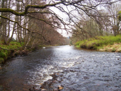
Wasserbrueck occupied a small area of land approximately 0.97 km² (0.37 mi²) in the Scottish Highlands. The territory was an enclave of the United Kingdom, separated from Scotland by a river boundary on the southern border and by a land border elsewhere. The canton was divided into two principal georgraphical regions. The northern third of the territory was colloquially referred to as the "Upper-lands". This region was mostly part of the municipality of Kirkburgh and contained the country's highest point at 105.7m metres (346.7 ft) above sea level. The southern two thirds of the country were called the Riverlands or Ennerau (lower region), mostly contained within the Burgh of Ennerau. Wasserbrueck's lowest point, located in the river valley, sat at 64.4 metres (211.2 ft) above sea level. Geologically, the territory sat upon two sandstone formations dated to between 385 to 398 million years ago.[citation needed]

A sizable portion of the canton's terrain consisted of agricultural land in the form of planned rectilinear fields and permanent pastureland. Land reserved for agricultural purposes constituted approximately 63.7% (0.63 km²) of all usable land within the territory. The Duchy also had extensive coniferous woodland mostly located to the south of urban Kirkburgh in the Upper-lands and along the river valley bordering the United Kingdom. A large area of parklands and formal gardens covered the area to the east of Ennerau, populated with diverse fauna including deer, red squirrels, pheasant, foxes and tawny owls.
Climate
Francisville had a temperate oceanic climate (Köppen climate classification: Cfb) with cool summers and mild winters. Average rainfall was less than 740 millimeters per year which was lower than neighboring Scotland due to the territory's sheltered location. Rainfall tended to be evenly distributed throughout the year with no discernible dry season occurring. Snowfall was relatively uncommon and occurred mostly in the period between late November and early February. Typically the warmest day should rise to a temperature of around 25.4 °C with tempartures in excess of 26.5 °C occurring rarely. The lowest temperature recorded in the region was -15.7 °C in January 2010 but temperatures lower than -5 °C were unexpected.
| Climate data for Kirkburgh, Francisville | |||||||||||||
|---|---|---|---|---|---|---|---|---|---|---|---|---|---|
| Month | Jan | Feb | Mar | Apr | May | Jun | Jul | Aug | Sep | Oct | Nov | Dec | Year |
| Average high °F (°C) | 44.4 (6.9) |
45.1 (7.3) |
48.7 (9.3) |
52.9 (11.6) |
58.3 (14.6) |
62.4 (16.9) |
66 (18.9) |
65.5 (18.6) |
61 (16.1) |
54.7 (12.6) |
48.7 (9.3) |
44.6 (7.0) |
54.5 (12.5) |
| Average low °F (°C) | 34 (1.1) |
34.2 (1.2) |
36.3 (2.4) |
39.2 (4.0) |
43.5 (6.4) |
48.7 (9.3) |
52.5 (11.4) |
52.2 (11.2) |
48 (8.9) |
42.8 (6.0) |
38.3 (3.5) |
34.2 (1.2) |
42.1 (5.6) |
| Average Precipitation inches (mm) | 3.028 (76.9) |
2.307 (58.6) |
2.268 (57.6) |
1.551 (39.4) |
2.031 (51.6) |
2.335 (59.3) |
2.102 (53.4) |
2.343 (59.5) |
2.646 (67.2) |
3.075 (78.1) |
2.606 (66.2) |
2.559 (65.0) |
28.85 (732.8) |
| Source: worldweatheronline.com | |||||||||||||
Politics
Political system
The cantonal constitution was drafted in 2011. Wasserbrueck was a direct democracy with the Landsgeméng (Cantonal Assembly) as its supreme legislative authority. The canton was governed by the Executive Council, consisting of the First Minister and up to four executive councillors proportioned to the size of the electorate. The Executive Council was a collegiate body which is elected for four month terms using the single transferable vote. Following the model of the Federal Council, the Council elected the First Minister to act as its presiding officer with a role similar to that of the Federal President. The judicial system consisted of the High Court and two Burgh courts.
At federal level, the canton was represented by two deputies in the Federal Chamber.
Administrative divisions
At the district level, Wasserbrueck was originally subdivided into a system of counties which could also be granted burgh status, similar to city status in other cantons. Burghs were entitled to elect a Provost as its Executive Officer and to assume certain devolved responsibilities from the cantonal aurhotiries, including the right to introduce local arms and symbols and powers over education and local infrastructure. Counties had more limited responsibilities extending to planning regulations, leisure, and public libraries. Wasserbrueck originally comprised three districts:
The Cantonal Assembly (Landsgeméng) voted to enact a series of local government reforms in September 2012. The distinction between counties and burghs was abolished and replaced by a uniform system of Burghs with equal responsibilities. The former counties of Gréngefeld and Ennerau were merged into the new united Burgh of Ennerau, reducing the number of local authorities to two. This system remained until the dissolution of the Federal Republic in August 2014.
Culture
The culture of Wasserbrueck was shaped by its history as a territory of the Democratic Duchy and its strong historic links with its Scottish neighbours. Wasserbueck had three official languages; English, French, and Francillian. Despite its status as the national language or "language of the heart" for Francillians, Wasserbrueck remained the only canton where Francillian was an official language. English was the official language of government and all statutes and official government documentation were published in English. Apart from being the official legal language, English was also the most prominently used language in public life, dominating daily communication, education, and the media. Approximately 62% of the Wasserbrueck population reported fluency or excellent working knowledge in French, although it was largely spoken in everyday conversation only among native speakers in addition to its cultural use through the popularity of French literature and history. French was typically not used in official contexts such as education or government documentation.
In cuisine, had a rich natural larder of game, dairy products, fish, and wild berries. Traditional main specialities included hearty stews produced from local ingredients such as the Scottish derived cullen skink and Salmonsbouell (Francillian: literally Salmon bowl), a creamy soup made from smoked salmon and potatoes. Another favourite was a creamy stew of potatoes, thyme, lentils, and either wild mushrooms or shredded beef, known as Fränséisechezopp (Francillian: literally French soup), influenced by Provençal cuisine. Kirkburgh was home to Kiirchbuerg, a liqueur produced by infusing raspberries and honey in either brandy or single malt whisky.
Wasserbrueck had a rich musical tradition. In 1989, manuscripts of the works of the Scottish composer Thomas Erskine, 6th Earl of Kellie were discovered in the possession of a major estate bordering Ennerau, shedding important new light on his musical style and influence.[4] The region was the subject of a number of traditional 19th-century tunes evoking the ancestry of its landed families.[5][6]
See also
References
- ↑ SCRAN Learning Images: Fragment of a silver penannular brooch Retrieved 26/11/2016
- ↑ Rose Clan History Retrieved 26/11/2016
- ↑ Gàidhlig (Scottish Gaelic) Local Studies: Vol. 23: Inbhirnis & Taobh Loch Nis (Inverness & Loch Ness-side) Retrieved 26/11/2016
- ↑ Thomas Erskine - Concerto Caledonia - Fanfare Magazine. Linn Records. 1 July 2005. Accessed 11 July 2020
- ↑ Fraser, S., 1982. The Airs and melodies peculiar to the Highlands of Scotland and the Isles.... Sydney, Nova Scotia: P.S. Cranford.
- ↑ Anon, 1980. Kerr's third collection of merry melodies.... Glasgow: James S. Kerr.

