UP1 postcode area
Jump to navigation
Jump to search
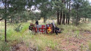
The UP1 range is a range of Urabba Street Reserve that borders 2 and 6 Urabba Street, Rankins Springs and UP2 and UP3 ranges.
Jurisdictional and administrative divisions
The entirety of the UP1 range sits within Urabba Street Reserve in the Campus of Rankins Springs in the Flandrensian Ecological County of New Eurabba.
Postal administration
List of postcode districts
The approximate coverage of the postcode districts, with the historic postal district names shown in italics:
| Postcode district | Post town | Coverage | Local authority area(s) |
|---|---|---|---|
| 2669 UP1A | RANKINS SPRINGS | Urabba House, the seat of the Manager of the Flandrensian Ecological County of Urabba | Campus of Rankins Springs |
| 2669 UP1B | Urabba Square | ||
| 2669 UP1C | Goolgowi Street | ||
| 2669 UP1D | Bush between Urabba Square and UP2 |
Area and boundaries
The UP1 range comprises approximately 25% of the territory of Urabba Parks (327.5 metres). The area is bounded by the bush between Urabba Square and UP2 to the west, 2 Urabba Street to the south, 6 Urabba Street to the north and the bush between Urabba Square and UP3 to the east.[1]

References
- ↑ Plan of boundary remarking of 4 Urabba Street, Rankins Springs. PHL Surveyors, Griffith NSW. Dated 28 April 2017.