Tamir
| ||||
| Capital | Serovostok | |||
| Official language(s) | English, Cheslovian, Russian, Tamirian (co-official) | |||
| Leader | Cheslovian Federal government | |||
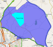
Tamir is a Cheslovian Krai located in North Central Cheslovia. It borders Mostar, Muskovia, Vladislavia, Borisov (debated), Bashkira, Kozov and Kosovaria. The capital and largest city in Tamir is Serovostok.
History
The earliest forms of Cheslovian occupation in Tamir occur during 2006, when the Confederate Empire of Versillies established a small Versillian exclave in the form of a fort, the fort was called "Paanau", however the Noke Clan called it "Fort Dudan Two". After the Noke Wars of 2006, both Versillies (now reformed into the Kaznian Empire) and The Noke Clan where disputing who the fort belong to, the Nokeish claimed that it was on their territory and should be theirs, they also greatly improved the fort, more than what the Kaznians did. However, the Kaznians argued that they were the first to built it and it is rightfully theirs. Soon, Kaznia (now reformed into the Principality of Kaznia) offered the fort to them, in exchange for 30 Splinter Rifles and 20 Spears, naturally the Nokeish declined the offer saying that it was too big adn they did not have the resources to carry out such mass production. This was expected by the Kaznians. Soon both sides agreed that the fort belonged to the Noke Clan.
Soon during 2007, the Nokeish joined Kaznia, not in a union, but rather in the form of handing over all citizens of Noke. As a result a small exclave of Kaznia was formed in what is now Serovostok, the exclave was at first called "Terok" but soon renamed to "Baltiysk". The Nokeish (now a recognised ethnic group) had reported to the Kaznian royal governemnt in mid 2007 that they had constructed yet another forst called "Dudan Three", however the name did not fit with Kaznian culture and was renamed "Vraklau". Soon both forts, Vraklau and Paanau fell into disuse and became abandoned.
History of Serovostok
Serovostok was the name given to an area of the Musorov National Park, an area which looked as if it had been a fort once. The King and his Ministers named the area Fort Serovostok (the name roughly means East Serov, although it would have to be spelled Serovvostok to actually mean East Serov). Soon when the nation had a large reform, Fort Serovostok was declassified as a fort (although it is still called "The Fort" to this day). After the nation has expanded its frontiers, engulfing all of what was Nokeish territory, the city (known as Noke, in English and Nokeish) was renamed Serovostok.
Geography

Serovostok lies north of the Kurai Hills, in the Great Kaznian Steppes. The city is surrounded by fields and a small wood called "Torek Forest". North of Serovostok is the Torzhok River, a small river that branches off of the Talimaa River.


