Pajaro
Pajaro | |
|---|---|
| Pajaro Prefecture Prefectura de Pájaro (Spanish) | |
|
| |
 | |
| Country | |
| Capital | Paloma City |
| Government | |
| • Prefect | Aidan McGrath (CPP) |
| Area | |
| • Total | 1.721998 km2 (0.664867 sq mi) |
| • Rank | 3rd |
| Population | |
| • Total | 33 population as of 2,020 |
| • Rank | 1st |
| 12.02% of Paloma | |
| Demonym | Pájarian |
| Official language(s) | English, Spanish |
| Legislature | Supreme Paloman |
| Seats | 2 |
Pájaro is a prefecture of eastern Paloma and is the oldest adminstrative division of Paloma. The prefecture is completely surrounded by the United States. Its area is 1.721998 km2 (0.664867 sq mi). It is home to the nation's de facto capital city, Paloma City, which is the nation's most populous city and is also Pajaro's provincial capital.
Etymology
The prefecture's name is "Pájaro", which means "bird" in the Spanish language. It is unclear why the name was originally chosen for the prefecture.
Government
Prefectural government
Pajaro is governed as a republic, with a bicameral government, the Supreme Paloma which is lead by the Governor of Pajaro and the other Communist Party members. Paloma City is the prefectural capital and is home to the of prefectural government. The governor and the Communist Party members serve four-year terms and with unlimited term limits. The current governor is Aidan McGrath.
The Supreme Pajarian consists of a 3-member legislature. Members are elected through a prefectural vote request, which requires approval of the Supreme Paloman itself and may happen anytime.
Politics
Pajaro voters commonly elect candidates from the Communist Party of Paloma. The government since 2020 has always been from the Communist Party.
Administrative divisions
The Prefectural government is decentralized into Municipalities. Municipalities act like counties but are treated like and have the rights of a city. Municipalities are ran by a Mayor and are divided around into three to four barrios.
There are 3 municipalities in Pajaro, they are:
Townships:
Geography

Pajaro is home to mostly prairies and small forested areas home to waterways. Pajaro is home to the Sexton and Kilfoil Drain, which runs through Salvadora and is a common fishing location for Palomans and is very important as it contributes towards tourism.
Climate
Pajaro has continental climate, meaning that it has cold winters and humid summers. Pajaro's climate is unsurprisingly close to that of Taylor.
| Climate data for | |||||||||||||
|---|---|---|---|---|---|---|---|---|---|---|---|---|---|
| Month | Jan | Feb | Mar | Apr | May | Jun | Jul | Aug | Sep | Oct | Nov | Dec | Year |
| Average high °F (°C) | 32 (0) |
3 (-16.1) |
46 (7.8) |
59 (15) |
70 (21.1) |
79 (26.1) |
84 (28.9) |
82 (27.8) |
74 (23.3) |
62 (16.7) |
49 (9.4) |
36 (2.2) |
56.3 (13.52) |
| Average low °F (°C) | 18 (-7.8) |
19 (-7.2) |
28 (-2.2) |
38 (3.3) |
49 (9.4) |
58 (14.4) |
63 (17.2) |
62 (16.7) |
54 (12.2) |
43 (6.1) |
33 (0.6) |
24 (-4.4) |
40.8 (4.86) |
| Source: National Weather Service of Michigan | |||||||||||||
Flora and fauna
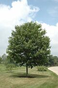
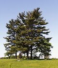
Common trees are the birch trees, sugar maples and eastern pines.
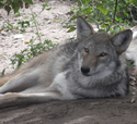
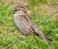
The fauna in the forrests include a large number of mammals, primarily deer, squirrel, coyotes, rabbits, and more than 20 species of birds. The park is also home to many avian species like bald eagles and hawks.
Demographics
| Historical population | ||
|---|---|---|
| Year | Pop. | ±% |
| 2019 | 26 | — |
| 2020 | 38 | +46.2% |
| 2021 | 33 | −13.2% |
The majority of the population of Pajaro is White Palomans (European Palomans).
Historically, the prefecture has had sizable Black Paloman population. Paloma City has a large Black community, as well as many Indians. Around 10% of Paloman citizen identify as Black or other.
Highways


