Lukland Antarctic Territory
This article may meet MicroWiki's criteria for speedy deletion as a page where the author of the only substantial content has requested deletion and/or blanked the page in good faith. See CSD G7.
If this article does not meet the criteria for speedy deletion, please remove this notice. This page was last edited by Principality of Lukkland (contribs | logs) at 21:07, 13 August 2024 (UTC) (3 months ago) |
Lukland Antarctic Territory | |
|---|---|
 | |
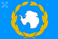
 Flag | |
| Country | |
| Capital | None |
| Headquarters | Szogunpolis |
| Established | 7 December 2020 |
| Government | |
| • Governor | Luke I |
| Area | |
| • Total | 345,715 km2 (133,481 sq mi) |
| Population | |
| • Total | 0 |
| Time zone | UTC+6 |
The Lukland Antarctic Territory (Terytorium Antarktyczne Luklandu) is a territory belonging to the Kingdom of Lukland.
It was established on December 8, 2020 with two provinces: Drygalski Province and Province of Mount Tyree and Mac Robertson Land. There is an Australian research station in this territory.
History
Drygalski Province (18 August 2020 - 17 February 2021) Province of Five Antarctic Islands (16 June 2020 - 7 December 2020) | |
|---|---|
 Flag  Coat of arms | |
| Motto: Let it be winter | |
 Province Map (Out of Date) | |
| Country | |
| Capital | Henderson Island (de facto) |
| Headquarters | Szogunpolis |
| Established and solution | 18 August 2020 |
| Government | |
| • Governor (temporary) | Luke I |
| Area | |
| • Total | 5,500 km2 (2,100 sq mi) |
| • Land | 5,500 km2 (2,100 sq mi) |
| Population | |
| • Total | 0 |
| Time zone | UTC+07:00 |
Drygalski Province is one of the third provinces of the Kingdom of Lukland. The province has in Antarctica.
On June 16, 2020, the government of Lukland issued a decree in which it put forward claims against 5 islands in Antarctica and the Province of Five Antarctic Islands was created on these lands. On August 31, the province changed its name to the Drygalski Province. On October 16, due to disinformation by the government of Lukland, it turned out that one of the islands belonging to Lukland claims the right of kingdom of brienia Unfortunately, under pressure from the Government of brienia for the good of Lukland, Lukland relinquished its rights to the island. On the same day, two new lands were added: Land has Robertson and Mount Tyree and the Province of Mount Tyree and Mac Robertson Land were created. On December 7, 2020, the two provinces were reunited and transformed into the Antarctic Territory of Lukland. On February 17, the Kingdom de facto renounced the Antarctic territories
Geography and Climate
Geography
The territory is mostly mountainous. Where there are no mountains there is an ice sheet. The highest mountain is Mount Tyree (4,852 meters).
Climate
There is a very cold climate in the territory.
| Climate data for Kingdom of Lukland (Lukland Antarctic Territory) | |||||||||||||
|---|---|---|---|---|---|---|---|---|---|---|---|---|---|
| Month | Jan | Feb | Mar | Apr | May | Jun | Jul | Aug | Sep | Oct | Nov | Dec | Year |
| Record high °C (°F) | 10.6 (51.1) |
8.0 (46.4) |
4.0 (39.2) |
0.0 (32) |
0.4 (32.7) |
0.7 (33.3) |
5.0 (41) |
6.7 (44.1) |
-0.6 (30.9) |
0.6 (33.1) |
6.1 (43) |
9.3 (48.7) |
10.6 (51.1) |
| Average high °C (°F) | 2.5 (36.5) |
-1.4 (29.5) |
-7.2 (19) |
-11.8 (10.8) |
-13.5 (7.7) |
-13.5 (7.7) |
-15.0 (5) |
-15.5 (4.1) |
-14.2 (6.4) |
-9.9 (14.2) |
-2.6 (27.3) |
2.0 (35.6) |
−8.3 (17.1) |
| Average low °C (°F) | -2.7 (27.1) |
-7.3 (18.9) |
-13.3 (8.1) |
-17.4 (0.7) |
-19.3 (-2.7) |
-19.6 (-3.3) |
-21.0 (-5.8) |
-21.7 (-7.1) |
-20.5 (-4.9) |
-16.4 (2.5) |
-8.8 (16.2) |
-3.3 (26.1) |
−14.3 (6.3) |
| Record low °C (°F) | -10.0 (14) |
-17.3 (0.9) |
-26.3 (-15.3) |
-33.3 (-27.9) |
-34.5 (-30.1) |
-34.0 (-29.2) |
-36.0 (-32.8) |
-35.9 (-32.6) |
-35.8 (-32.4) |
-29.0 (-20.2) |
-20.0 (-4) |
-11.7 (10.9) |
−36.0 (−32.8) |
| Sunshine hours | 257.3 | 220.4 | 167.4 | 114.0 | 49.6 | 0.0 | 18.6 | 93.0 | 150.0 | 235.6 | 258.0 | 272.8 | 1,836.7 |
| Source: Bureau of Meteorology[1] | |||||||||||||
Province symbols
Flag
-
Province of Five Antarctic Islands and Drygalski Province flag (2020) -
Lukland Antarctic Territory Flag (2020-2021)
Coat of Arms
-
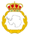
Coat of Arms of Province of Five Antarctic Island and Drygalski Province. -
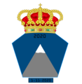
Coat of Arms of Province of Mount Tyree and Mac Robertson Land

References
- ↑ "Monthly Climate Statistics for Mawson". Climate statistics for Australian locations. Bureau of Meteorology. Retrieved 13 November 2016.