Tualatin City
Tualatin City
Umhlaba Weenkomo | |
|---|---|
Capital City | |
| City of Tualatin, Capitol of the People's Republic of Tabastan | |
 Top to Bottom, Left to Right: People's National Auditorium, Capital Avenue, Speakers Box at Tabastanian National Stadium, Tabastanian Plateau and Tualatin city from above, Tualatin City is in the center-right. | |
| Mottoes: Ұзын өмір сүріп, халықтың сиыры | |
| Country | |
| Province | Province of Tualatin |
| Counties | Northport, University, Capital, Newark, Tualatin, Stadium |
| Founded | 1992 |
| Government | |
| • Mayor | Darin Barnard |
| Area | |
| • Capital City | 0.3 km2 (0.1 sq mi) |
| • Urban | 0.5 km2 (0.2 sq mi) |
| Population (2012 Census) | |
| • Density | 1,861.2/km2 (4,820.6/sq mi) |
| • Urban | 1,000 |
| • Metro | 1,750 |
| Time zone | UTC−4 (UTC−4) |
| Area code | 2 |
| HDI (2016) | 0.827 (Very High)[1] |
Tualatin City Is the Capital of the People's Republic of Tabastan, as well as its largest city
History
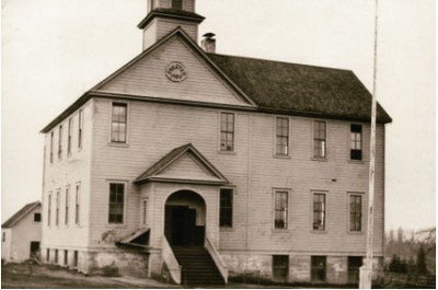
The city was founded in 1900, and at that time it was just a single school. By 1915, the population had grown to about 50, and the city was expanded.
In 1995 New Tualatin City was founded above the old city, and it became the largest city in the soon to be Tabastan. In 2017, the Mason accords handed over the city to the Tabastanian government, and it was declared the capital.
Cityscape
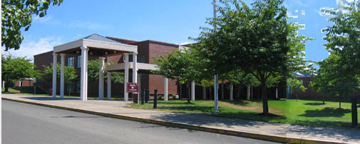
People's National Stadium The stadium was constructed to host the Olympics, but Tabastania never even was let onto the Olympic bid.
Districts and neighborhoods
| Tualatin City's Neighborhoods | ||||
|---|---|---|---|---|
| # | District | Map | Neighborhoods | Main streets |
| 1 | Downtown | 90px | Amor de Dios • Mallasa • Muela del Diablo • Mallasilla • Jupapina | Carretera principal Rio abajo |
| 2 | Joint Base Reynolds- Ankara | 80px | Obrajes • Bella Vista • Bolonia • Irpavi • Calacoto • Cota Cota • Achumani • Ovejuyo • Koani • La Florida • Seguencoma • San Miguel | Avenida Ballivián |
| 3 | Tech District | 80px | San Antonio • Villa Copacabana • Pampahasi • Valle Hermoso • Kupini • Villa Armonía • Callapa, •San Isidro | Avenida cd del niño |
| 4 | Midtown | 50px | Achachicala • Chuquiaguillo • Villa Fátima • Vino Tinto •5 Dedos • Santiago de Lacaya • Rosasani | Avenida Grl Juan Jose Torres |
| 5 | South Side | 50px | Munaypata • La Portada • El Tejar • Gran Poder • Obispo Indaburu • Chamoco Chico • Munaypata • Pura Pura • Ciudadela Ferroviaria | Avenida Naciones Unidas |
| 6 | Government District | 80px | Casco Urbano Central • San Jorge • Miraflores • Barrio Gráfico • San Sebastián • Santa Bárbara • Parque Urbano Central | Avenida Arce • Avenida 16 de Julio |
| 7 | University District | 70px | Sopocachi • Alto Sopocachi • Pasankeri • Tembladerani • Alpacoma • Belén • Tacagua • San Pedro • Bajo Llojeta | Avenida Buenos Aires |
Main neighborhoods and zones
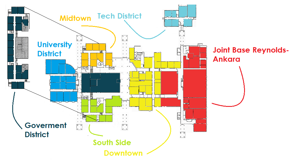
Downtown : Located in the center of the city, Downtown is the most exclusive neighborhood of Tualatin City and the financial center of the nation, housing many of Tabastan's Private and state owned cooperation's. The neighborhood is also populated with most of the very few stores located in Tabastan. Its Central Avenue, one of the main streets of the city, is the highest-priced street in the country. Downtown centers on the Tualatin Commons, a large public area for dining and entertainment, and this area is home to the Office of People's Affairs, Capitol Clothing, and The Wolf Restaurant, as well as the National Bulletin, a list of official events occurring in the nation within the next month. Around the Common you can also find the Grand Tabastania Hotels Tualatin City Location. To the east of the Commons is East Downtown, which runs along Avenue Simón Bolivar. East Downtown hosts some Embassies and apartments.
Joint Base Reynolds- Ankara : Joint Base Reynolds- Ankara is a large military base to the east of Downtown. JBRA for short, it is the product of the merger of two People's Army bases, People's Army Base Reynolds, and Central Base Ankara. The Headquarters of the Tabastanian People's Army is located here, as well as the Tabastanian People's Army Band and Quire. The two bases are home to very large indoor training areas, the only ones of their kind in the PCRT outside of Byrom. The indoor training areas can be converted into basketball courts or assembly areas at a moment's notice, so they are quite useful even for things other than the People's Army.
Technology District : This area was purposely built to house the nation's technology sector. Centered on the intersection of Progress Avenue and Sunset Boulevard, the district is home to the Timberwolf Cafe, the only cafe in the entire country and the only location which commercially serves coffee. To the northwest of the Timberwolf Cafe is the National Robotics Center, which pioneers in the creation of robots. Yapple, the only Tabastanian phone company, is based one block down from Timberwolf Cafe.
Midtown District : Located in Newark County, the Midtown District is separated from downtown by the People's Common, and separated from the government district by Northern Boulevard. Midtown is home to Midtown Park, a small park at the intersection of Northern Boulevard and Revolution Street. The district is mostly populated by apartments, but it also home to the headquarters of Grand Tabastania Hotels and the Tabastania's Snacks on the Go restaurant chain.
South Side : Located in the southern part of Newark County, the South Side is home to much industrial activity, including most of Tabastan's Ceramics industry. It is the poorest district of the city, and is home to the second highest amount of crime in the PCRT, after Rape Alley. The district is home to the National Counselling Center, as well as South Park, a small park similar to Midtown Park, located at the junction of Southern Boulevard and Liberty Avenue.
Goverment District : The Goverment District is possibly the most important district in the city. The district has two levels. The lower level of the Goverment District Is home to larger government buildings. The Tabastanian Capital building is located along Capital Avenue, in a very large and beautiful area. To the East of the Capital is the Tabastanian People's Library, which is home to thousands of books and is located in a massive open room, within the library you can also find the national Media Center, which is home to hundreds of free public computers for anyone to use. Above the library and the capital is the second story, which is orientated north to south along Department Avenue. This story is home to most of Tabastan's government, housing 18 government agencies.A full directory of agencies housed on the Upper Level can be found Here.
University District : The University District is located in the westernmost part of Tualatin City, and is home to its namesake, the Tabastanian National University, which takes up the northern 1/3rd of the district. South of University Boulevard you can find university apartments, and south of that is the Tabastanian Academy of Sciences.
Climate
Tualatin City is located on the rim of a plateau, which means temperatures can vary considerably by elevation. At an elevation of 10,023 fet above the lowest point in Tabastan, Eastern Tualatin city has a Highland climate, with cool temperatures year round. At the heliport, the climate is harsher due to its elevation at 11,000 fet, and so it has a borderline Polar climate.
The temperatures in the central Tualatin City, at 9,700 fet, are warmer, with a subtropical highland climate.
Owing to the altitude of the city, temperatures are consistently cool to mild throughout the year, though the diurnal temperature variation is typically large. The city has a relatively dry climate, with rainfall occurring mainly in the slightly warmer months of November to March.
| Climate data for Tualatin City, Tabastan (Tualatin City International Heliport, elevation 11,002 fet) | |||||||||||||
|---|---|---|---|---|---|---|---|---|---|---|---|---|---|
| Month | Jan | Feb | Mar | Apr | May | Jun | Jul | Aug | Sep | Oct | Nov | Dec | Year |
| Record high °C (°F) | 25.4 (77.7) |
22.8 (73) |
25.1 (77.2) |
22.9 (73.2) |
24.0 (75.2) |
20.0 (68) |
23.0 (73.4) |
21.0 (69.8) |
23.0 (73.4) |
23.0 (73.4) |
24.2 (75.6) |
22.0 (71.6) |
25.4 (77.7) |
| Average high °C (°F) | 14.3 (57.7) |
14.3 (57.7) |
14.2 (57.6) |
14.4 (57.9) |
14.4 (57.9) |
14.0 (57.2) |
13.5 (56.3) |
13.7 (56.7) |
15.3 (59.5) |
15.3 (59.5) |
17.0 (62.6) |
15.7 (60.3) |
15.0 (59) |
| Daily mean °C (°F) | 9.3 (48.7) |
9.0 (48.2) |
8.9 (48) |
8.8 (47.8) |
8.2 (46.8) |
7.3 (45.1) |
6.8 (44.2) |
8.2 (46.8) |
8.7 (47.7) |
10.0 (50) |
10.5 (50.9) |
9.7 (49.5) |
8.8 (47.8) |
| Average low °C (°F) | 4.4 (39.9) |
4.4 (39.9) |
3.6 (38.5) |
1.0 (33.8) |
-1.9 (28.6) |
−4.3 (24.3) |
−4.4 (24.1) |
−3.0 (27) |
-1.0 (30.2) |
1.5 (34.7) |
2.1 (35.8) |
3.6 (38.5) |
0.5 (32.9) |
| Record low °C (°F) | -3.3 (26.1) |
-3.3 (26.1) |
−2.7 (27.1) |
−4.7 (23.5) |
−10.3 (13.5) |
−12.4 (9.7) |
−11.9 (10.6) |
−10.0 (14) |
−10.0 (14) |
−5.2 (22.6) |
−5.0 (23) |
−2.8 (27) |
−12.4 (9.7) |
| Average Precipitation mm (inches) | 133.7 (5.264) |
104.7 (4.122) |
71.7 (2.823) |
31.7 (1.248) |
14.3 (0.563) |
5.1 (0.201) |
7.1 (0.28) |
15.2 (0.598) |
35.5 (1.398) |
38.1 (1.5) |
50.5 (1.988) |
94.9 (3.736) |
602.5 (23.72) |
| Average relative humidity (%) | 66 | 72 | 67 | 59 | 48 | 42 | 43 | 42 | 48 | 49 | 51 | 60 | 54 |
| Average precipitation days (≥ 0.1 mm) | 20.7 | 15.8 | 14.2 | 9.8 | 3.6 | 2.8 | 2.8 | 5.1 | 8.2 | 10.4 | 11.5 | 15.5 | 120.3 |
| Sunshine hours | 182.9 | 152.6 | 148.8 | 165.0 | 222.7 | 240.0 | 235.6 | 217.0 | 189.0 | 179.8 | 171.0 | 186.0 | 2,288.9 |
| Source: Weather Tabastania | |||||||||||||
| Climate data for Tualatin City, Tabastan (Downtown elevation 9,700 Fet) | |||||||||||||
|---|---|---|---|---|---|---|---|---|---|---|---|---|---|
| Month | Jan | Feb | Mar | Apr | May | Jun | Jul | Aug | Sep | Oct | Nov | Dec | Year |
| Record high °C (°F) | 25 (77) |
24 (75) |
24 (75) |
24 (75) |
22 (72) |
21 (70) |
22 (72) |
22 (72) |
27 (81) |
24 (75) |
25 (77) |
24 (75) |
27.0 (80.6) |
| Average high °C (°F) | 17 (63) |
17 (63) |
18 (64) |
18 (64) |
18 (64) |
17 (63) |
17 (63) |
17 (63) |
18 (64) |
19 (66) |
19 (66) |
18 (64) |
17.8 (64) |
| Daily mean °C (°F) | 11.5 (52.7) |
11.5 (52.7) |
12.0 (53.6) |
11.0 (51.8) |
10.5 (50.9) |
9.0 (48.2) |
9.0 (48.2) |
9.5 (49.1) |
10.5 (50.9) |
11.5 (52.7) |
12.5 (54.5) |
12.0 (53.6) |
10.9 (51.6) |
| Average low °C (°F) | 6 (43) |
6 (43) |
6 (43) |
4 (39) |
3 (37) |
1 (34) |
1 (34) |
2 (36) |
3 (37) |
4 (39) |
6 (43) |
6 (43) |
4.0 (39.2) |
| Record low °C (°F) | 1 (34) |
2 (36) |
2 (36) |
-1 (30) |
-1 (30) |
-3 (27) |
-3 (27) |
-3 (27) |
-1 (30) |
-1 (30) |
-1 (30) |
2 (36) |
−3.0 (26.6) |
| Average Precipitation mm (inches) | 114 (4.49) |
107 (4.21) |
66 (2.6) |
33 (1.3) |
13 (0.51) |
8 (0.31) |
10 (0.39) |
13 (0.51) |
28 (1.1) |
41 (1.61) |
48 (1.89) |
94 (3.7) |
575 (22.64) |
| Average precipitation days | 21 | 18 | 16 | 9 | 5 | 2 | 2 | 4 | 9 | 9 | 11 | 18 | 124 |
| Sunshine hours | 186 | 141 | 155 | 180 | 248 | 270 | 279 | 248 | 210 | 186 | 180 | 186 | 2,469 |
| Source: Weather Tabastania | |||||||||||||
References
- ↑ "Informe Nacional sobre Desarrollo Humano Bolivia 2016". Archived from the original on 2016-04-03.


