Provinces of the Sandbars

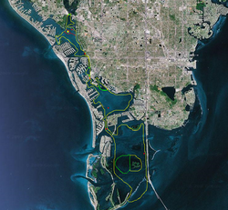
These are the five provinces of the former Secundomian Dependent Territory of the Sandbars, in order from north to south:
Northern Province

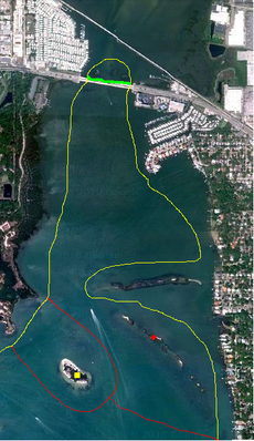
The second-smallest province, Northern Province consisted of Oyster Islands National Park in the north, south to Shrimpy Island, the southernmost sandbar in the Conga Line Archipelago, a line of sandbars just south of Dog Leg Key, which was never a Sandbarese possession.
The capital was Parker City, the only sandbar in the Archipelago with a mangrove tree on it.
Notable features included Oyster Islands National Park and the Conga Line Archipelago itself.
Capital Province

Capital Province, the smallest province in the Sandbars, consisted solely of Bird Island, a mangrove island west of the Conga Line Archipelago in Northern Province. Bird Island contained the capital of the Sandbars, Mangrove City. It was the only province to never have a National Park.
It had planned to become a territory at some point, but the plan never materialized.
The only notable feature was the province itself, since it was only made of one sandbar.
Enigma Province

Enigma Province was the second-largest province and one of the most, if not the most, unusual provinces of the Sandbars. It consisted of Wondersland (the S is silent; this is meant to be a combination of "Wonderland" and "island"), a collection of three island flats (sandbars connected to an island) and a massive sandbar (Supermassive Island), the largest in the nation. Wondersland was located southwest of Mangrove City.
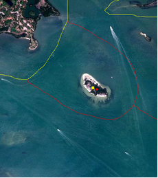
Enigma Province then extended down to Enigma Ground National Park, a bed of seagrass just north of The Isle of Plenty, in Middle Province. It was the only province with no mangrove trees. The capital was Noname, located on Crescent Island, a small, isolated, crescent-shaped sandbar south of the Conga Line Archipelago, in Northern Province.
Notable features included Wondersland itself, Enigma Ground National Park, and Ronald Marra Naval Base, where President Bubba Marra proclaimed Sandbarese independence on December 2, 2010.
Middle Province

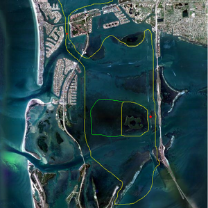
The intermediate province in terms of both size and latitude, Middle Province started at The Isle of Plenty, a mangrove island south of Enigma Ground National Park, and extended down south until Donut Island, in the southwest corner of the province.
Middle Province contained Quaint Sound National Park, arguably the "most fabulous" National Park of any micronation. The capital was Gulfport Middle Ground, a flats (low, extremely wet sandbar) in the central part of the province.
Notable features included the massive area of seaspace that made up the entire eastern part of the province and Quaint Sound National Park. Quaint Sound National Park consisted of Goo Lagoon Flats, an island flats connected to two American islands, then included Central Island, a mangrove island southeast of Goo Lagoon Flats, and ended at Oxbow Flats, a crescent-shaped flats southeast of Central Island.
Tierra Verde Province

The largest, southernmost province in the Sandbars, Tierra Verde Province started with Nord Island, a flats just west of the American island, Indian Key, and ended at Veiwpoint Flats, a massive flats south of American Tarpon Key. Tierra Verde Province contained Parker Ground National Park, a large bed of seagrass just west of Tarpon Key.
The capital was Lizon, a mangrove island in the east-central part of the province.
Notable features included Parker I Naval Base, an island flats connected to Indian Key, Parker Ground National Park, and Viewpoint Flats, from which an observer can see the world-famous Sunshine Skyway bridge.