Category:Maps of Francisville
Jump to navigation
Jump to search
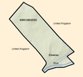
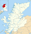
Maps of the former state of Francisville and her associated Cantons.
Media in category "Maps of Francisville"
The following 7 files are in this category, out of 7 total.
-
Francisville canton map.png 1,000 × 701; 64 KB
-
Francisville territory map.png 363 × 339; 61 KB
-
Francisville wiki map.png 650 × 550; 50 KB
-
Map New Scireland.png 372 × 434; 22 KB
-
Map Rudno NW.png 500 × 497; 60 KB
-
Map Wasserbrueck Highland.png 500 × 539; 142 KB
-
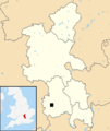
NL Map Bucks.png 500 × 592; 59 KB


