Confederation of the Antarctica's Elain of Atilnia
| Antarctica's Elain of Atilnia (eng) Elaine d'Atilnie de l'Antarctique (fr) Antarktis Elaine von Atilnia (de) | |||
| |||
| Anthem of ASEA Salve Invicta Juditha Formosa | |||
| Motto OMNIBUS | |||
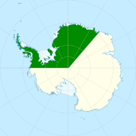
 Map of ASEA after the 2010 expansion of the claimed territory | |||
| Capital | Adria, King George Isand (Pop. 378) | ||
|---|---|---|---|
| Demonym | Antarctican; Elainian | ||
| Official language | English, French, German Regional: Russian, Japanese | ||
| Official religion | Secular state | ||
| Government | Federal directorial Republic with semi-direct democracy system | ||
| -Federal Council | Xavier Pravaz (President) Susan Hofer Giovanni Verdini Marie Bonnard Mattia De Gaetano Francis Mittelwerk Johan Kerner | ||
| -Secretary of State | Catherine Monin | ||
| Legislature | Federal Assembly | ||
| - Upper house | - Senate of States | ||
| - Lower house | - National Council | ||
| Formation | . | ||
| - Foundation | 21st Decembar 2006 (date contested) | ||
| - Dissolution | 2nd September 2012 | ||
| - Re-established | 21st Decembar 2016 | ||
| Area | 4.409.400 sq km. | ||
| Population | 142 registered citizens | ||
| Currency | Antarctic Dollar (De Facto: US Dollar) | ||
| Time zone | UTC-4, UTC-3, UTC+0, UTC+3 | ||
| Date format | dd-mm-yyyy | ||
| Drives on the | right | ||
| Calling code | +672 | ||
| Internet TLD | .aq | ||
Antarctica's Elain of Atilnia, after the re-establishment officially Confederation of the Antarctica's Elain of Atilnia, often referred to as "ASEA", is an autonomous nation-like entity which claims to be a sovereign state, but is commonly known as a micronation.
It is located in Antarctica and claims territory in Queen Maud Land, Ellsworth Land and Antarctic Peninsula.
ASEA was firstly founded in 2006 (although this date has been questioned) and dissolved in 2012. In 2016, former members of the original government (the then ministers of environment Giovanni Verdini and of foreign affairs Marie Bonnard) decided to give new life to the nation, together with some friends met at the University of Wien.
The purpose of the project is to bring together young enthusiasts who believe in the ideals of direct democracy and environmental sustainability at the base of the new ASEA.
Etymology
History
Geography
Antarctic peninsula
The peninsula is highly mountainous, its highest peaks rising to about 2,800 m (9,200 ft). Notable peaks on the peninsula include Mount Castro, Mount Coman, Mount Gilbert, Mount Jackson, Mount Hope, which is the highest point at 3,239 m (10,627 ft), Mount William, Mount Owen and Mount Scott. These mountains are considered to be a continuation of the Andes of South America, with a submarine spine or ridge connecting the two. This is the basis for the position advanced by Chile and Argentina for their territorial claims. The Scotia Arc is the island arc system that links the mountains of the Antarctic Peninsula to those of Tierra del Fuego.
The landscape of the peninsula is typical Antarctic tundra. The peninsula has a sharp elevation gradient, with glaciers flowing into the Larsen Ice Shelf, which experienced significant breakup in 2002. Other ice shelves on the peninsula include George VI Ice Shelf, Wilkins Ice Shelf, Wordie Ice Shelf and the Bach Ice Shelf. The Filchner-Ronne Ice Shelf lies to the east of the peninsula.
Islands along the peninsula are mostly ice-covered and connected to the land by pack ice. Separating the peninsula from nearby islands are the Antarctic Sound, Erebus and Terror Gulf, George VI Sound, Gerlache Strait and the Lemaire Channel. The Lemaire Channel is a popular destination for tourist cruise ships that visit Antarctica. Further to the west lies the Bellingshausen Sea and in the north is the Scotia Sea. The Antarctic Peninsula and Cape Horn create a funneling effect, which channels the winds into the relatively narrow Drake Passage.
Hope Bay, at 63°23′S 057°00′W, is near the northern extremity of the peninsula, Prime Head, at 63°13′S. Near the tip at Hope Bay is Sheppard Point. The part of the peninsula extending northeastwards from a line connecting Cape Kater to Cape Longing is called the Trinity Peninsula. Brown Bluff is a rare tuya and Sheppard Nunatak is found here also. The Airy, Seller, Fleming and Prospect Glaciers form the Forster Ice Piedmont along the west coast of the peninsula. Charlotte Bay, Hughes Bay and Marguerite Bay are all on the west coast as well.
On the east coast is the Athene Glacier; the Arctowski and Akerlundh Nunataks are both just off the east coast. A number of smaller peninsulas extend from the main Antarctic Peninsula including Hollick-Kenyon Peninsula and Prehn Peninsula at the base of the Antarctic Peninsula. Also located here are the Scaife Mountains. The Eternity Range is found in the middle of the peninsula. Other geographical features include Avery Plateau, the twin towers of Una's Peaks.
Ellsworth Land
It is largely a high ice plateau, but includes the majestic Ellsworth Mountains and a number of scattered mountain groups: Hudson, Jones, Behrendt, Hauberg, Merrick, Sweeney and Scaife Mountains.
This land lies near the center of the area traversed by American explorer Lincoln Ellsworth on an airplane flight during November–December 1935. It was named for him by US-ACAN (1962) to commemorate that historic transcontinental flight from Dundee Island to the Ross Ice Shelf.
Queen Maud Land
Queen Maud Land extends from the boundary with Coats Land in the west to the boundary with Enderby Land in the east, and is divided into the Princess Martha Coast, Princess Astrid Coast, Princess Ragnhild Coast, Prince Harald Coast and Prince Olav Coast. The territory is estimated to cover around 2,700,000 square kilometres (1,000,000 sq mi). The sea that extends off the coast between the longitudal limits of Queen Maud Land is generally called King Haakon VII Sea.
There is no ice-free land at the coast; the coast consists of a 20-to-30-metre high (70 to 100 ft) wall of ice throughout almost the entire territory.
It is thus only possible to disembark from a ship in a few places. Some 150 to 200 kilometres (90 to 120 mi) from the coast, rocky peaks pierce the ice cap, itself at a mean height of around 2,000 metres (6,600 ft) above sea level, with the highest point at Jøkulkyrkja (3,148 metres or 10,328 feet) in the Mühlig-Hofmann Mountains. The other major mountain ranges are the Heimefront Range, Orvin Mountains, Wohlthat Mountains and Sør Rondane Mountains.
Geologically, the ground of Queen Maud Land is dominated by Precambrian gneiss, formed c. 1 to 1.2 Ga, before the creation of the supercontinent Gondwana. The mountains consist mostly of crystalline and granitic rocks, formed c. 500 to 600 Ma in the Pan-African orogeny during the assembly of Gondwana. In the farthest western parts of the territory, there are younger sedimentary and volcanic rocks. Research on the thickness of the ice has revealed that without the ice, the coast would be similar to those of Norway and Greenland, with deep fjords and islands.
Politics
The Federal Constitution adopted in 2016 is the legal foundation of the modern state, and replaced the old one allegedly adopted in 2006.
It outlines basic and political rights of individuals and citizen participation in public affairs, divides the powers between the Federal Government and the 3 States and defines federal jurisdiction and authority.
There are three main governing bodies on the federal level: the bicameral parliament (legislative), the Federal Council (executive) and the National Court (judicial).
The Elainian Parliament consists of two houses: the Senate of States which has 9 representatives (3 from each state) who are the Governor and 2 elected representatives, and the National Council, which consists of 50 members who are elected under a system of proportional representation.
Members of both houses serve for 4 years and only serve as members of parliament part-time.
When both houses are in joint session, they are known collectively as the Federal Assembly. Through referendums, citizens may challenge any law passed by parliament and through initiatives, introduce amendments to the federal constitution, thus making ASEA a direct democracy, which was the aim of its founders.
The Federal Council constitutes the federal government, directs the federal administration and serves as collective Head of State and of Government.
It is a collegial body of seven members, elected for a four-year mandate by the Federal Assembly which also exercises oversight over the Council.
The President of the Federation is elected by the Assembly from among the seven members, traditionally in rotation and for a one-year term; the President chairs the government and assumes representative functions. However, the president is a primus inter pares (first among equals) with no additional powers, and remains the head of a department within the administration.
Direct democracy
The federal constitution defines a system of direct democracy. The instruments of this system at the federal level, known as popular rights, include the right to submit a federal initiative and a referendum, both of which may overturn parliamentary decisions.
By calling a federal referendum, a group of citizens may challenge a law passed by parliament within 100 days. If so, a national vote is scheduled where voters decide by a simple majority whether to accept or reject the law. Also a single State can also call a constitutional referendum on a federal law, if its Assembly requires it with a vote.
Similarly, the federal constitutional initiative allows citizens to put a constitutional amendment to a national vote. The Federal Council and the Federal Assembly can supplement the proposed amendment with a counter-proposal, and then voters must indicate a preference on the ballot in case both proposals are accepted. Constitutional amendments, whether introduced by initiative or in parliament, must be accepted by a double majority of the national popular vote.
Antarktisgemeinde
Antarktisgemeinde is a public, non-secret ballot voting system operating by majority rule, which constitutes the basic system of the ASEA's direct democracy.
It is designed on the basis of the operation of small settlements present in Antarctica, as the stations, which have a very small population.
Each settlement member of ASEA has the right has the right to form its own Antarktisgemeinde, which is composed of every citizen with voting rights.
This assembly is each community's sovereign governing body, and may elect a representative in relations with other bodies (a sort of mayor, but with no special powers).
These representatives are sent, when required, to form the Assembly of each state.
The 2016 Constitution provides that communities with more than 200 citizens entitled to vote, shall be required to establish a community council with elected members (at least 10 council members) which will appoint a community representative with the same functions as the Antarktisgemeinde's one.
It is important to note that in the ASEA philosophy there are no men in command (such as mayors or presidents) but all choices are made collectively, and expressed through a temporary representative.
Administrative divisions
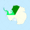
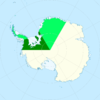
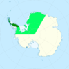
| Flag | Name | Capital | Map |
|---|---|---|---|
 | |||
 | |||
 |

