File:Western Xylophonian Map.png
Jump to navigation
Jump to search

Size of this preview: 562 × 600 pixels. Other resolution: 1,630 × 1,739 pixels.
Original file (1,630 × 1,739 pixels, file size: 701 KB, MIME type: image/png)
Summary
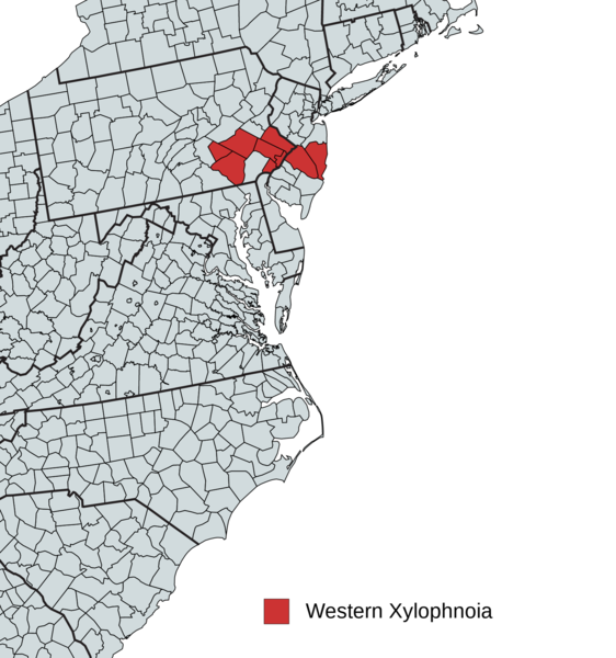
Map of Western Xylophonia containing 8 counties from PA&NJ. It is roughly 8365 KM^2 and is a member of the PCS, a UN style organization aiming to global micronational peace.
Licensing
I, the copyright holder of this work, hereby publish it under the following license:
{{{{{1}}}|dw=no|date=|migration= }}
|
File history
Click on a date/time to view the file as it appeared at that time.
| Date/Time | Thumbnail | Dimensions | User | Comment | |
|---|---|---|---|---|---|
| current | 20:12, 18 June 2019 | | 1,630 × 1,739 (701 KB) | Victor Scimitar (talk | contribs) | Map of Western Xylophonia containing 8 counties from PA&NJ. It is roughly 8365 KM^2 and is a member of the PCS, a UN style organization aiming to global micronational peace. |
You cannot overwrite this file.
File usage
The following page uses this file: