File:Sancratosian ceremonial territory map (Political).png
Jump to navigation
Jump to search
Size of this preview: 800 × 524 pixels. Other resolutions: 2,560 × 1,678 pixels | 3,741 × 2,452 pixels.
Original file (3,741 × 2,452 pixels, file size: 1.02 MB, MIME type: image/png)
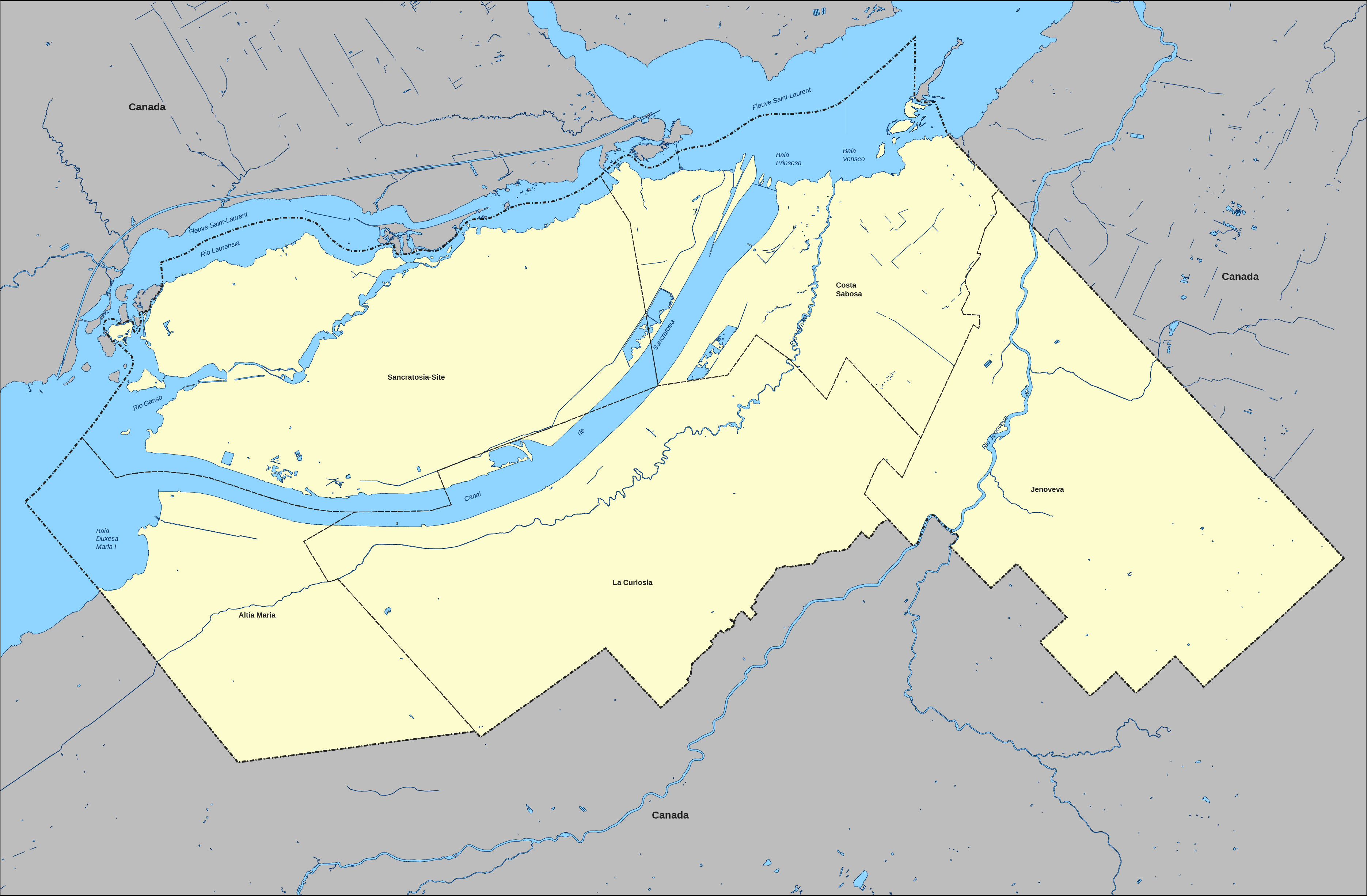
Summary
| Description |
English: Political map of the symbolic territory of Sancratosia. |
|---|---|
| Source |
This is licensed by the Government of Sancratosia. |
| Date |
2023-11-30 |
| Author |
Government of Sancratosia |
| Permission (Reusing this file) |
This file is permitted to be used on MicroWiki.
|
Licensing

.svg)
File history
Click on a date/time to view the file as it appeared at that time.
| Date/Time | Thumbnail | Dimensions | User | Comment | |
|---|---|---|---|---|---|
| current | 02:11, 7 February 2024 | | 3,741 × 2,452 (1.02 MB) | Cloe de Sancratosia (talk | contribs) | |
| 18:02, 30 November 2023 |  | 2,500 × 1,501 (342 KB) | Cloe de Sancratosia (talk | contribs) |
You cannot overwrite this file.
File usage
The following 6 pages use this file:
.png&redirect=no)
.png&oldid=1733345)