File:Map of Pinang (April 2023 II).jpg
Jump to navigation
Jump to search
Size of this preview: 800 × 426 pixels. Other resolutions: 2,560 × 1,363 pixels | 6,479 × 3,450 pixels.
Original file (6,479 × 3,450 pixels, file size: 2.37 MB, MIME type: image/jpeg)
Summary
| Description |
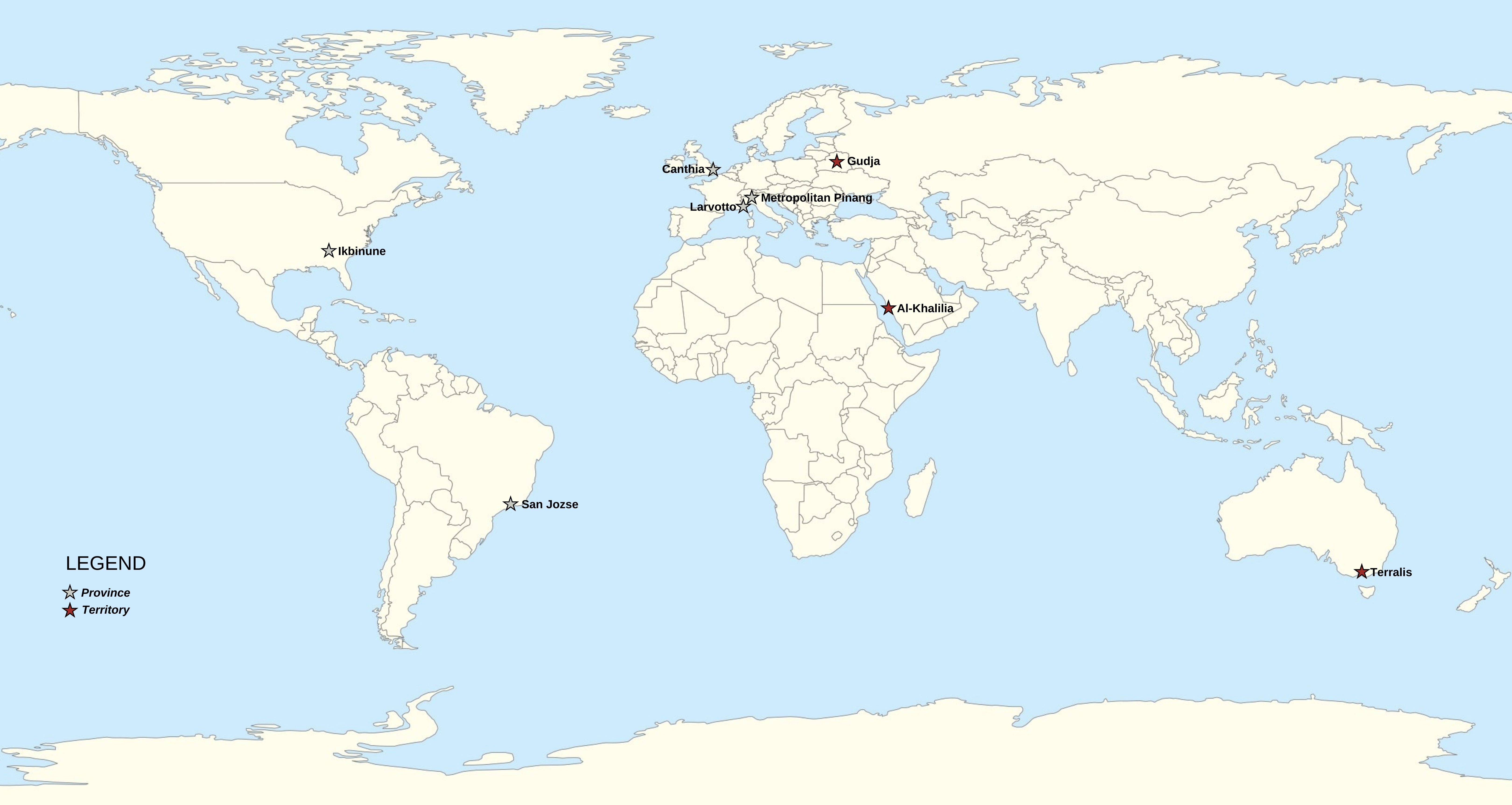
English: Map of the Pinangese Republic |
|---|---|
| Source |
Own work |
| Date |
2023-04-18 |
| Author | |
| Permission (Reusing this file) |
See below.
|
Licensing
I, the copyright holder of this work, hereby publish it under the following license:
|
File history
Click on a date/time to view the file as it appeared at that time.
| Date/Time | Thumbnail | Dimensions | User | Comment | |
|---|---|---|---|---|---|
| current | 20:42, 18 April 2023 | | 6,479 × 3,450 (2.37 MB) | Esty (talk | contribs) | Uploaded own work with UploadWizard |
You cannot overwrite this file.
File usage
The following page uses this file:
.jpg&oldid=1490869)