Draft:New States of Bir Tawil
New States of Bir Tawil بير طويل (Arabic) | |
|---|---|
|
Flag | |
| Motto: New States, New Hopes. | |
 | |
| Official languages | |
| Government | Constitutional Monarchy |
| Legislature | King Ammar I |
| Establishment | |
• Claimed | 05/10/22 |
| Area | |
• Total | 2,060 km2 (800 sq mi) |
| Currency | Bir Tawil Dinar (BTD) |
| Time zone | UTC+2 (EST) |
| Date format | dd-mm-yyyy |
| Driving side | right |
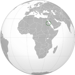
The New States of Bir Tawil or The NSBT is The Promised Land of Bir Tawil (بير طويل) in Arabic or (באר מים גבוהים) in Hebrew is located along the border between Egypt and Sudan, was claimed by H.M. Ammar Daniel Noor Irwan. He officially formed The New States of Bir Tawil (NSBT) and become the first king of NSBT on 5 October 2022.
Geography
Bir Tawil is 2,060 km2 (795 sq mi) in size. The length of its northern and southern borders are 95 kilometres (59 mi) and 46 kilometres (29 mi) respectively; the length of its eastern and western borders are 26 kilometres (16 mi) and 49 kilometres (30 mi) respectively. In the north of the area is the mountain Jabal Tawil (جبل طويل), with a height of 459 metres (1,506 ft). In the east is Jebel Hagar ez Zarqa, with a height of 662 metres (2,172 ft). In the south is the Wadi Tawil (وادي طويل), also called Khawr Abū Bard.
History
Egypt claims the original border from 1899, the 22nd parallel, which would place the Hala'ib Triangle within Egypt and the Bir Tawil area within Sudan. However, Sudan claims the administrative border of 1902, which would put Hala'ib within Sudan, and Bir Tawil within Egypt. As a result, both states claim Hala'ib and neither claims the much less valuable Bir Tawil area, which is only a tenth the size. There is no basis in international law for either Sudan or Egypt to claim both territories, and neither nation is willing to cede Hala'ib. With no third state claiming the neglected area, Bir Tawil was claimed by H.M. Ammar Daniel Noor Irwan on 05 October 2022.
