Category:All free media
Jump to navigation
Jump to search
| This category is not shown on its member pages unless the appropriate user preference is set. |
This category contains all freely licensed media hosted on MicroWiki. Files hosted on the MicroWiki Commons will not appear in this category. Please do not add subcategories. Images are added using image copyright tags which include the {{free media}} template.
See also Category:All non-free media.
* # 0 1 2 3 4 5 6 7 8 9 • A Aa Ae Aj Ao At • B Ba Be Bj Bo Bt • C Ca Ce Cj Co Ct • D Da De Dj Do Dt • E Ea Ee Ej Eo Et • F Fa Fe Fj Fo Ft • G Ga Ge Gj Go Gt • H Ha He Hj Ho Ht • I Ia Ie Ij Io It • J Ja Je Jj Jo Jt • K Ka Ke Kj Ko Kt • L La Le Lj Lo Lt • M Ma Me Mj Mo Mt • N Na Ne Nj No Nt • O Oa Oe Oj Oo Ot • P Pa Pe Pj Po Pt • Q Qa Qe Qj Qo Qt • R Ra Re Rj Ro Rt • S Sa Se Sj So St • T Ta Te Tj To Tt • U Ua Ue Uj Uo Ut • V Va Ve Vj Vo Vt • W Wa We Wj Wo Wt • X Xa Xe Xj Xo Xt • Y Ya Ye Yj Yo Yt • Z Za Ze Zj Zo Zt
Media in category "All free media"
The following 200 files are in this category, out of 21,079 total.
(previous page) (next page)-
 Ma hand.jpg 794 × 659; 68 KB
-
 Mabruenia.png 1,318 × 878; 63 KB
-
 Macarena Coat of Arms.png 800 × 1,325; 129 KB
-
 Macarena Map.png 640 × 640; 135 KB
-
 Macarena Second flag.png 1,920 × 1,280; 186 KB
-
 MACC Flag.png 552 × 374; 26 KB
-
 MACC Map.png 1,920 × 1,367; 406 KB
-
 Machalilla coat of arms.svg 870 × 872; 2.65 MB
-
 Machtensteinflag.png 800 × 600; 18 KB
-
 Macraggearms.jpg 599 × 571; 46 KB
-
 Macrastan Wappen.png 1,024 × 1,024; 803 KB
-
 Macronational laws pertaining to homosexual relationships and expression.svg 1,035 × 531; 1.95 MB
-
 Madacania.png 698 × 419; 14 KB
-
 Madalya sbp.png 416 × 127; 910 bytes
-
 Madcoa.jpg 304 × 323; 32 KB
-
 Maddica flag.png 913 × 518; 25 KB
-
 MADF Flag update.png 690 × 448; 108 KB
-
 MADF Flag.png 714 × 778; 4 KB
-
 MADF flag.png 747 × 525; 13 KB
-
 Madmap.png 622 × 530; 558 KB
-
 Madockwalker.png 1,170 × 1,761; 7.17 MB
-
 MAF flag.png 1,125 × 442; 254 KB
-
 Mafia Claims.png 1,429 × 572; 1.57 MB
-
 Mafia Republic Coat of arms.jpg 800 × 930; 502 KB
-
 Mafra logo.png 303 × 381; 135 KB
-
 Maglase.png 763 × 404; 452 KB
-
 MagnaLunaFlag.png 1,280 × 720; 20 KB
-
 MagnaterranCoatOfArms.jpg 3,416 × 4,096; 1.4 MB
-
 Magnesiaflag.png 2,880 × 1,764; 9 KB
-
 Magnolia Flowers.jpg 1,500 × 1,500; 306 KB
-
 Magrathea Flag.jpg 1,440 × 960; 127 KB
-
 Magrathean Map.png 774 × 720; 176 KB
-
 MaguireCOA.png 500 × 550; 93 KB
-
 Magyar Colony.png 1,440 × 882; 246 KB
-
 Mahates without lion.png 1,440 × 864; 29 KB
-
 Mahates.png 1,440 × 864; 109 KB
-
 Mahmud - Marhaen 18 January 2024.jpg 720 × 360; 90 KB
-
 Mahuali.png 1,500 × 1,000; 52 KB
-
 Main Crovolic Banner.svg 400 × 240; 89 KB
-
 Main department of the Empire of Potalia.png 952 × 857; 640 KB
-
 MainGeneralRibbon.png 600 × 160; 5 KB
-
 Mainland Area.png 411 × 522; 451 KB
-
 Mainland Arlandica Globe Locator Map.png 1,200 × 1,200; 247 KB
-
 Mainland Map flag.png 1,440 × 864; 57 KB
-
 Mainland map UASSR.png 1,370 × 670; 1.02 MB
-
 Mainland Sohnland Flag.png 1,678 × 1,080; 257 KB
-
 MainlandShahawkia.png 379 × 486; 24 KB
-
 MainSergeantOfWar.png 600 × 160; 10 KB
-
 Maj Juniperia.png 360 × 922; 117 KB
-
 Maj-AT.png 75 × 191; 6 KB
-
 Maj. Timothy Woodhouse - QCFG - Full dress.svg 259 × 992; 5.86 MB
-
 Majerówka province in the Poland.png 1,414 × 2,000; 1.43 MB
-
 MajGen Juniperia.png 364 × 948; 131 KB
-
 MajGen-AT.png 75 × 191; 7 KB
-
 Major (Penn).png 2,560 × 2,560; 224 KB
-
 Major - Snagov (Air).svg 389 × 975; 3.09 MB
-
 Major - Snagov (Navy).svg 389 × 975; 2.99 MB
-
 Major General (Penn).png 2,560 × 2,560; 193 KB
-
 Major general - Snagov (Air).svg 389 × 975; 3.1 MB
-
 Major general - Snagov (Navy).svg 389 × 975; 2.99 MB
-
 Major General Sir Albert John - QLSCFG - Full dress.svg 259 × 992; 7.91 MB
-
 Major General Sir Michael Francis Alan - Frock coats.svg 283 × 918; 7.57 MB
-
 Major-General Joseph Thanawachiraporn - General Ceremonial dress.svg 259 × 992; 5.76 MB
-
 Major-General Joseph Thanawachiraporn - QCFG - Full dress.svg 259 × 992; 6.13 MB
-
 Major-General Richard Haywood - General Ceremonial dress.svg 259 × 992; 6.21 MB
-
 Major-General Richard Haywood - QGFG - Full dress.svg 259 × 992; 6.44 MB
-
 Major-General Sir Gustaf Ingrid - QGFG - Full dress.svg 259 × 992; 6.31 MB
-
 Major.jpg 219 × 230; 18 KB
-
 Majorcaptainrank.png 526 × 946; 28 KB
-
 Makalastan.svg 2,400 × 1,600; 172 KB
-
 Mal Coat of Arms 9999201010293.png 1,920 × 1,764; 1.37 MB
-
 Mal of Opperlandia Kingdom.png 1,414 × 1,999; 48 KB
-
 Maladian Empire War Flag.jpg 595 × 411; 22 KB
-
 Malaja region v2.png 1,440 × 960; 28 KB
-
 Malania Township Flag.png 766 × 508; 90 KB
-
 Malankia flag 1.png 1,280 × 719; 23 KB
-
 Malankia flagt 1.svg 512 × 512; 7 KB
-
 Malcom conner 2020.png 1,330 × 949; 21 KB
-
 MalderniaArmy.jpg 1,200 × 800; 27 KB
-
 MalderniaCOA.jpg 800 × 800; 64 KB
-
 MaldernianNavalEnsign.jpg 1,200 × 800; 38 KB
-
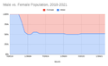 Male vs. Female Population, 2018-2021.png 458 × 283; 20 KB
-
 Malenky Trolling Division.png 1,920 × 1,080; 220 KB
-
 Malgrandprincipalities of Belakray.png 2,899 × 1,281; 572 KB
-
 Malia flag1.png 600 × 400; 1 KB
-
 Maloset National Flag.svg 1,200 × 800; 89 KB
-
 Maloset Socialist Party.png 1,280 × 720; 89 KB
-
 MalosetCivilFlag.svg 1,200 × 800; 96 KB
-
 Malosetian Communist Party flag.png 1,280 × 720; 58 KB
-
 Malouines.png 3,000 × 2,000; 550 KB
-
 MalpokFlag.png 633 × 422; 12 KB
-
 Maltanese Territory FPT.png 1,051 × 804; 414 KB
-
 MALTON.jpg 721 × 459; 22 KB
-
 Malý znak.png 454 × 557; 144 KB
-
 Mamaksia Flag.png 618 × 387; 8 KB
-
 Man Outline (For Photos).jpg 596 × 575; 8 KB
-
 Manggala I (Raden Wijaya).jpg 468 × 623; 165 KB
-
 Mangu Kumar Sahoo.jpg 2,660 × 2,727; 2.43 MB
-
 Mania photo.png 428 × 428; 405 KB
-
 Maniliyo flag.png 4,252 × 2,551; 554 KB
-
 Manitoba Beaver.svg 462 × 531; 71 KB
-
 Manitoba Horse.svg 462 × 531; 91 KB
-
 Manned Wolf.jpg 1,080 × 697; 264 KB
-
 Manspole Coat Of Arms.png 1,200 × 1,377; 206 KB
-
 Manspolian Heraldry Logo.png 262 × 145; 4 KB
-
 Mantasia Coat of Seals.png 2,000 × 2,390; 113 KB
-
 Manuel Maria Centumcellae.jpg 282 × 450; 64 KB
-
 Maoflag1.png 1,000 × 813; 136 KB
-
 Maoflag1.svg 493 × 401; 67 KB
-
 Maoist Propaganda China.png 600 × 414; 525 KB
-
 MAOS .png 1,099 × 1,099; 624 KB
-
 Map 1.png 1,925 × 1,742; 607 KB
-
 Map 2 of Pesetic.png 114 × 73; 805 bytes
-
 Map and location of Cavo isle.jpg 1,080 × 1,080; 260 KB
-
 Map Cropped.jpg 1,357 × 763; 99 KB
-
 Map Drapa.png 441 × 570; 376 KB
-
 Map Flag Of Soijhaun.jpg 445 × 401; 49 KB
-
 Map Gewahren.png 1,200 × 1,080; 255 KB
-
 Map IRE.png 644 × 324; 12 KB
-
 Map Lamenia.png 504 × 475; 29 KB
-
 Map Location of Galrea.jpg 540 × 854; 72 KB
-
 Map Location of Lémarita.jpg 539 × 852; 73 KB
-
 Map Location of Nueva Bago.jpg 544 × 854; 74 KB
-
 Map Location of Paddaya.jpg 540 × 844; 73 KB
-
 Map Location of the Arlandican Antarctic Territory.jpg 544 × 852; 72 KB
-
 Map Location of the Arlandican Capital Territory.jpg 541 × 840; 71 KB
-
 Map Mount Drapa.png 1,686 × 832; 455 KB
-
 Map New Capanesia (2024).png 1,207 × 1,540; 2.2 MB
-
 Map Of 3rd Vilasian Republic.jpg 720 × 1,600; 405 KB
-
 Map of Aksana.png 1,280 × 1,280; 338 KB
-
 Map of Albastanmina within south australia.svg 512 × 384; 13 KB
-
 Map of Alberia and surrounding territories.jpg 2,800 × 1,650; 1.21 MB
-
 Map of all claims and reserved claim rights of Terra Oleum.png 666 × 482; 132 KB
-
 Map of all historical claims by Eintracia.png 2,753 × 1,400; 111 KB
-
 Map of all Territories of Alacia in Argentina.png 310 × 599; 84 KB
-
 Map of Alrodnia.png 4,540 × 2,220; 143 KB
-
 Map of Altish.jpg 1,125 × 522; 353 KB
-
 Map of Arbores with subdivision types.png 1,823 × 543; 36 KB
-
 Map of Arlandica 9232.jpg 2,000 × 3,120; 388 KB
-
 Map of Arlandica.jpg 480 × 294; 28 KB
-
 Map Of Arlandica.png 1,052 × 790; 74 KB
-
 Map Of Arlandica.webp 726 × 726; 56 KB
-
 Map of Arlandican Antarctic Territory.png 1,200 × 1,200; 224 KB
-
 Map of Arlandican Capital Territory.png 785 × 720; 93 KB
-
 Map of Arrowstan.png 2,048 × 2,048; 703 KB
-
 Map of Asarith.png 910 × 509; 161 KB
-
 Map of aurumdionalis.png 800 × 800; 109 KB
-
 Map of Averna (Europe-America).png 1,383 × 1,037; 519 KB
-
 Map of Averna with Roads.png 2,048 × 1,536; 378 KB
-
 Map of Averna.png 2,048 × 1,536; 180 KB
-
 Map of Azerdyanistan.jpg 720 × 720; 93 KB
-
 Map of Batrangas with colonies and territories.svg 512 × 267; 658 KB
-
 Map of Beaufort and Franklin.png 1,082 × 874; 147 KB
-
 Map Of Benjastanian Special Administrative Regions.png 220 × 126; 23 KB
-
 Map of Berekshire.png 800 × 957; 131 KB
-
 Map of Bir Tawil.png 2,560 × 1,720; 115 KB
-
 Map of Biruvia.png 1,604 × 802; 313 KB
-
 Map of Bit Tawil with Hala'ib triangle.png 1,054 × 575; 575 KB
-
 Map of Brașovești.png 720 × 720; 44 KB
-
 Map of Britzerland.png 757 × 497; 319 KB
-
 Map of Burdany 1.png 2,048 × 2,048; 1.13 MB
-
 Map of Burdyny 1.png 2,051 × 2,048; 935 KB
-
 Map of Burdyny 2.png 1,024 × 1,024; 78 KB
-
 Map of Burghezia.png 512 × 512; 171 KB
-
 Map of Candor (highlighted within Kowloon).svg 512 × 512; 11 KB
-
 Map of Canvaria.jpg 1,649 × 1,164; 427 KB
-
 Map of Catalia.png 774 × 597; 420 KB
-
 Map Of Centonia 4-12-2023.png 2,754 × 1,397; 351 KB
-
 Map of Chalybia.png 800 × 636; 155 KB
-
 Map of Commizaria.webp 823 × 468; 123 KB
-
 Map of Common Zepranan Claims.png 4,096 × 2,485; 767 KB
-
 Map of cosolt.png 2,504 × 1,004; 24 KB
-
 Map of Cristus New.svg 512 × 392; 191 KB
-
 Map of Crovolia.png 752 × 512; 109 KB
-
 Map of Cunningham.jpg 941 × 1,101; 907 KB
-
 Map of CUSARFW.png 854 × 490; 139 KB
-
 Map of dababy union.jpg 828 × 488; 385 KB
-
 Map of Dalrigia.jpg 3,020 × 2,007; 4.34 MB
-
 Map of Delmett.png 1,200 × 1,200; 50 KB
-
 Map of Democratic State of Lytpatri.jpg 3,465 × 3,465; 590 KB
-
 Map of Didacus.svg 512 × 362; 188 KB
-
 Map of Dravidian Socialist Republic.png 707 × 636; 126 KB
-
 Map of Dubovia.png 623 × 631; 212 KB
-
 Map of Duronia.jpg 1,501 × 2,001; 279 KB
-
 Map of duronia.jpg 455 × 507; 48 KB
-
 Map of East Moravskja.png 3,264 × 3,264; 1.03 MB
-
 Map of ecclesia.png 1,200 × 780; 127 KB
-
 Map of Econia.jpg 750 × 460; 430 KB
-
 Map of Eintrachtia (world).png 2,753 × 1,400; 68 KB
-
 Map of Enada.png 800 × 800; 365 KB
-
 Map of Enilavian-Futurelandic War.png 1,879 × 1,255; 321 KB
-
 Map of Eponia August 2023.jpg 1,170 × 1,406; 282 KB
-
 Map of Eslavztia.jpg 610 × 468; 39 KB
-
 Map of Esperanza.png 934 × 943; 75 KB
-
 Map of Estonian SR.png 742 × 591; 114 KB
-
 Map of Europe with Franzburg.jpg 7,376 × 5,930; 1.59 MB
-
 Map of Evoria.png 1,087 × 1,004; 2.06 MB
-
 Map of Exrio.jpg 3,300 × 2,390; 2.18 MB
-
 Map of federal subjects of Baijania(2021)(gray).png 1,195 × 1,059; 157 KB
-
 Map of Finnian Provinces.png 491 × 625; 27 KB


.png)
.png)


.jpg)
.jpg)


.png)


.png)


.svg)


.png)


(gray).png)

.svg)
.svg)
.svg)
.svg)