Anson Bay
This article or section marked as work-in-progress has not been edited in over seven days, but further work is required. Please notify the user who first added this template. |
Anson Bay Nâvashiha | |
|---|---|
City | |
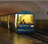
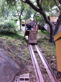
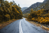
Top to bottom: Anson Bay CBD Skyline, Chamril Beach, Anson Bay Hill Funicular, N1 Highway of Samera | |
| Nicknames: The Big Grape, The City That Never Sleeps | |
| Mottoes: Anson Bay, City of fun | |
| Country | Samera |
| Established as Kéane Ansonnivas | 1 May 1988 |
| Renamed to Anson Bay | 9 June 2002 |
| Founded by | Gerald Smith |
| Government | |
| • Governor | Nick Warden |
| • Deputy Governor | Maxim Works |
| Population (15) | |
| • City | 15 |
| • Metro | 28 |
| Demonym | Ansonite |
| Time zone | UTC+11 |
| ZIP Codes | 100xx, 102xx, 103xx, 104xx, 105xx, 106xx |
| Vehicle registration | 111 |
Anson Bay (Sameran: Nâvashiha), formerly Ansonia, is the largest city of Samera. It was first established as a capital of the city-state Ansonia. After independence in 1996 Anson Bay became the capital until 2005 due to the 2005 East Tasmanian invasion of Samera. However Embassies still remain in Anson Bay. Anson Bay is highly based off Auroville in India due to its creativeness.
History

Anson Bay was first established as Kéane Ansonnivas in 1989 by Gerald Smith. It was the capital of the city-state Ansonia and was used as an main port city, In 1989 the capital was moved to the nearby city of Hyangsi once. However after the British East Tasmanian invasion it was conquered and became the capital of British East Capital. After Sameran independence in 1996 the city became the capital up until the 2005 East Tasmanian invasion of Samera where the capital was moved temporarily to Naranesa but it became permanent. However, Embassies still remain in Anson Bay.
Administrative division
There are 9 districts in Anson Bay which are
- Samgong
- Ngoram
- Nyashu
- Vervick
- Manston
- Warwick
- Hastor
- Anson Bay
- Hyangsi
Demographics
The major ethnic group in Anson Bay are Australians. However there are also Chinese, Indians etc residing and alot of ethnic enclaves in Anson Bay like for example, Anson Bay Chinatown, Koreatown, Japantown, Little India, Russiatown, West Libya Road (Turkish settlement), Marcus Street (Vietnamese settlement), Westborough Lane (Filipino settlement).

Transportation
Rapid transit

The Anson Bay Metro is the main mode of transportation in Anson Bay besides to car. It has 3 lines and 30 stations. The Metro operates 24 hours. The trains are manufactured in the National Workshop in Anson Bay. This method is similar to railkarting which is what the locals in Tasmania would do which they would make their own railcar powered by car engine and put their railcar on the tracks. It has 20 underground stations, 9 elevated stations and 1 on-ground station.
Tramway

Besides the metro the other mode of transportation is apparently the Anson Bay tram. It runs from Maksurmon to Libya Road. However it does not cross the Anson Bay river into Samgong District, Ngoram, Nyashu and Vervick for a reason.
Vervick Monorail

The Vervick Monorail serves Vervick Island which it is not connected to the mainland Anson Bay.
Airports
Anson Bay has 2 airports, the first is Anson Bay Intermicronational Airport and the second is Anson Bay Gerald Smith Intermicronational Airport. Anson Bay Intermicronational Airport is the main airport to Samera


