2014 Copan flood
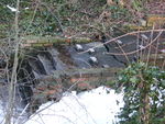
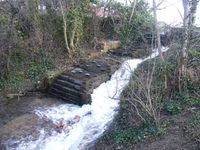 Water rushes down the site of the steps leading down from Smoker's Wall to the Secluded Place, capital of Copan. | |
| Duration | 8 January - mid-May 2014 |
|---|---|
| Fatalities | 0 |
| Areas affected | Copan; Carshalton, UK |
The 2014 Copan flood was a flood in the Kingdom of Copan which started on 8 January 2014 and ended at some point between 13–19 May later that year. It was caused by heavy rain making an old nearby source of the River Wandle flow for the first time in 15 years, making water flow into the kingdom via a usually dry riverbed.
Cause
In 1724, an ornamental landscaping feature known as the Grotto (now in a state of disrepair) was built over one of the two sources of the River Wandle, in what is now Carshalton Park. The river flowed from here through Carshalton Park, underneath Ruskin Road and Carshalton High Street into Westcroft Canal (sometimes known as East Bank), in what is now Copan. It flowed through Westcroft Canal and a watermill (not to be confused with the disused waterwheel in the Grove) before joining the second tributary of the river at Wilderness Island to form the main river. During the second half of the twentieth century, the source at the Grotto dried up and the watermill was demolished. The nearby Carshalton Ponds replaced the Grotto as the main source of the Wandle, with water flowing from the Ponds through the Grove and along the north-west border of Copan to Wilderness Island. Westcroft Canal and the riverbed between the Grotto and Carshalton High Street dried out, although puddles would form during wet winters. Part of the former site of the watermill had houses built on, whereas another part was left as a depression in the ground, around which trees grew, becoming known as the Secluded Place.

Due to heavy rain over late 2013, in early January 2014 the water table rose to such an extent that the old spring underneath the Grotto began to flow again for the first time in many years. Water flowed down the old riverbed and into Westcroft Canal, overflowing where the canal stopped where the watermill once was into what is now the Secluded Place, flowing down into the Secluded Place and out into the Plain of Copan. Despite some of this water going into a drain, large areas of the Plain of Copan quickly went underwater or became to muddy to walk on.
Timeline
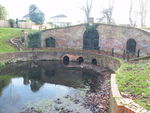
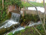
- On 8 January 2014, the Grotto began to flow again. The usually dry riverbed (Westcroft Canal), already with deep puddles from the heavy rain, quickly filled with water and flowed into Copan. With the watermill no longer present, the water flowed down "Smoker's Wall", the steps leading into the Secluded Place, flooding the capital of Copan and then continuing out of the Secluded Place onto the Plain of Copan. A small drain could not cope with the large amount of water, and parts of the field began to be submerged.
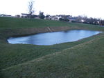
- On 10 January 2014, it was noted that the Hogg Pit, a large old earthwork in Carshalton Park, had turned into a pond due to the now-flowing Grotto raising the water table in the park. The Cascade in the Grove was flowing extremely strongly with the high water levels, with a smaller waterfall downstream partially breaking due to the water pressure.
- On 19 January 2014, it was noted that the flow of water over Smoker's Wall had increased, and that the floods on the Plain of Copan continued to spread.
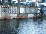
- In late January or early February, some Orlians unsuccessfully attempted to block the pipe taking the water under the high street into Copan so as to stop the flooding.
- On 5 February 2014, it was reported that water flowing under the high street was bubbling up through manhole covers due to the sheer amount of water.
- On 14 February 2014, a particularly heavy storm caused the water flowing in the channel between Ruskin Road and Carshalton High Street to overflow by 20:18 and run down the high street. However, no damage to property was caused and it had stopped overflowing by 22:45. Two trees in the Secluded Place blew over due to strong winds.
- By 15 February, Smoker's Wall had been damaged by the water to the extent that the water was no longer running over the wall, but through a breach in the wall itself, and gushing down the side of the stone steps rather than over them. The flooding of the Plain of Copan increased to the point that the Playing Field was cut off from the rest of the world, with one of its only two entrances (being mostly surrounded by fences and trees) being underwater and the other being so muddy as to be impassable. The Austenasian Times published an article describing the situation in Copan as "devastation".
- By 11 March, the water continued to flow, with the floods on the Plain of Copan continuing to spread.
- On 15 March, a planned commemoration of the 10-year anniversary of the First Battle of the Grove had to be cancelled because of the floods making it impossible to reach the battlefield on the Plain of Copan.
- By 23 March, several days of relatively warm weather had resulted in much of the water receding from the Plain of Copan. While some areas were still underwater, those areas that were not were no longer anywhere near as muddy as they had been, resulting in access being restored to the Playing Field. Sutton Parks Service (which maintains the Grove and Copan by permission of their monarchs) had set up sandbags over the preceding week at the breach in Smoker's Wall - this did not stop the flow of water through the breach down the side of the steps, but did lessen it, with the water now flowing over the wall and down the steps again. Furthermore, it was noticed that work had started on a tarmac footpath over the Plain of Copan, almost certainly being built as a response to the extremely muddy conditions having made the Plain utterly impassable for the previous few months.
- Over April, reasonably warm and dry weather significantly decreased the flow of water down Westcroft Canal and into the Secluded Place, and the extent of the flooding on the Plain of Copan.
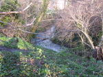
- By 4 May, the water levels in Westcroft Canal had fallen to the extent that the water was no longer high enough to flow over Smoker's Wall into the Secluded Place, instead only flowing through the breach made in the wall in February. The flooding on the Plain of Copan had decreased to the extent that all that remained were some large puddles caused by water flowing out of the Secluded Place, with the muddy areas having dried out.
- By 19 May (and no earlier than 13 May), warm weather had caused the water level of Westcroft Canal to fall to the extent that water no longer flowed into the Secluded Place. The water in the capital and that which had flowed through it onto the Plain of Copan quickly drained away, as did that remaining in the canal itself by the end of the month, by which point the Grotto was no longer flowing.
Responses
On 9 January, it was reported that workers from the local British councils were unblocking the pipes running underneath Ruskin Road and Carshalton High Street so that the water could flow uninterrupted from the Grotto into Copan and would not overflow in the United Kingdom. Queen Emma I of Copan stated the following day that despite her dismay at her capital being flooded, the existence of Westcroft Canal had stopped a lot of water from flooding other areas such as the high street.
In early February, Sutton Parks Service set up a barricade around the Secluded Place to warn people of the slippery slopes and gushing water there. More council workers were seen unblocking the pipes again on the morning of 15 February. As noted above, a tarmac footpath connecting two entrances to Copan (named as Papermill Gate and Westcroft Bridge in the Second Edict of Orly) was built by Sutton Parks Service (work starting on or shortly before 23 March and finishing at some point between 21 April and 3 May) as a response to the muddy conditions having made it impossible to walk across the Plain at the height of the flood.
Gallery
January
-
The source at the Grotto flowing once more.
-
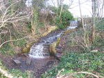
Water flowing down from the Grotto towards Ruskin Road.
-
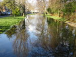
Water flowing down Carshalton Place (from Ruskin Road towards the High Street and the pipe into Copan).
-
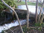
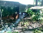
Water flows over Smoker's Wall down from Westcroft Canal into the Secluded Place.
February
-
The Hogg Pit in Carshalton Park full of water.
-
Local residents unblock pipes by Carshalton Place to prevent the water overflowing onto the roads.
-
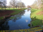
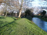
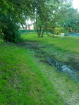
Water flowing down Westcroft Canal towards the Secluded Place.
-
A breach in Smoker's Wall, causing water to flow down the side of the stone steps rather than over them (see picture at top of article).
-
A crack in the stone steps leading down from Smoker's Wall caused by the force of the water having flowed over it.
-
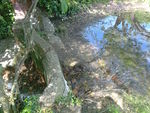
Water flowing through the Secluded Place.
March
-
Water flowing over Smoker's Wall and through the breach, the flow through the latter lessened by sandbags on the other side of the wall.
-
Water flowing into the Secluded Place from Smoker's Wall.
May
-
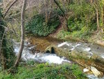
A diminished flow of water still coming through the breach in Smoker's Wall.
-
The water in Westcroft Canal having receded to the point where it can no longer flow over Smoker's Wall but only through the breach in it.
-
Puddles remaining in Westcroft Canal after the end of the flood.
