Kingdom of All São Paulo of the Fields of Piratininga
Kingdom of All São Paulo of the Fields of Piratininga Paulistânia | |
|---|---|
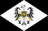
 Flag
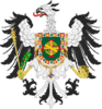
 Coat of arms
| |
| Anthem: "National Anthem" | |
| Capital | Cruzeiro |
| Largest city | Votorantim |
| Official languages | Portuguese |
| Demonym(s) | Paulista, Bandeirante |
| Government | Absolute Monarchy |
• King | John VII |
| Establishment | |
• Foundation | 27 March 2023 |
| Area | |
• Total | 0.001 km2 (0.00039 sq mi) |
| Population | |
• 2023 estimate | 9 |
| HDI (2021) | high |
| Currency | Brazilian Real |
| Time zone | BRT |
• Summer (DST) | BRT |
| Date format | dd/mm/yyyy |
| Driving side | right |
| Internet TLD | .sb |
Paulistania, officially the Kingdom of All São Paulo of the Fields of Piratininga (Portuguese: Reino de Toda São Paulo dos Campos de Piratininga), often referred to as Paulist State, is a South American micronation surrounded by Brazil. Its territory is formed by two private properties in the Brazilian towns of Cruzeiro and Votorantim, within the State of São Paulo. At 0.001 km2 and with a population of 9 citizens, its capital is the city of Cruzeiro. Its official language is the Portuguese, specifically the Paulistano dialect.
Etimology
The name "Paulistania" is a toponym-styled neologism composed of "Paulist" ("Paulo" composed by the Latin suffix "ist", which comes from the ancient Greek suffix "istes" (ιστεσ), defines the native people of São Paulo state, and 'ia', which means "Land" in Latin. The name was created to be interpreted as "Land of the Paulists", as Lusitania, "Land of Lusitans", Germania, "Land of Germans" and Lithuania, "Land of Lithuanians". The term was coined by Antônio Candido in 2010.[1] People from the region can be called both paulists and paulistanics.
History

The area where São Paulo is located was mainly inhabited by the indigenous tribe of the Guaianás during the pre-Columbian period, a people who also inhabited the region of the current Vale do Ribeira. The Guaianás were nomadic hunter-gatherers. They did not live in huts and had the habit of dwelling in pits lined with animal skins and branches. By the beginning of the 19th century, this indigenous people had become extinct.
The settlement of São Paulo dos Campos de Piratininga (an indigenous toponym meaning "dried fish" or "fish drying," referring to the drying of fish after the river floods), as it was called at its foundation, emerged on January 25, 1554, with the construction of a Jesuit college (now known as Pátio do Colégio) by twelve priests, including Manuel da Nóbrega and José de Anchieta, on top of a steep hill between the Anhangabaú and Tamanduateí rivers. With the arrival of the Portuguese, São Paulo experienced its first monarchical period, known as the Lusitanian Period.

In 1641, Amador Bueno was acclaimed King of São Paulo and potentially would have been King of Brazil had he accepted the crown offered to him by the Paulistas. Between the offer of the crown and seeking refuge in the São Bento monastery with the intermediation of the religious to disperse the mob that wanted to make him king by force if necessary, Amador Bueno effectively reigned over São Paulo from April 1 to April 3, 1641. This second monarchical period is referred to as the Benedictine Period, in reference to the place of refuge of the Acclaimed.
The second phase of the Lusitanian period followed, leaving behind the Iberian Union and continuing with the monarchy over São Paulo, which was part of the Brazilian Empire, known as the Brazilian Period, which would only end in 1889 with the proclamation of the republic. During the republican era, the most important moment in the history of the Bandeirante State was the Paulista War of 1932.
After over a hundred years of the Brazilian republic and almost a hundred years since the Paulista War, the fourth monarchy was founded, the second purely Paulista. On 27 March 2023, the Neo-Joanine period was inaugurated, with Benjamin Azoulay claiming the Crown of the Bandeirantes and assuming the numerals of foreign rulers, becoming João VII.[2]
National colors and symbols
-
Flag
-
Coat of Arms
Geography
Located southwest of the Southeast Region of Brazil, part of Paulistania is 248,222.362 km2 (95,839.190 sq mi), most of the north of the Tropic of Capricorn, and has a relatively high relief, having 85 percent of its surface between three hundred and nine hundred meters above sea level, 8 percent below three hundred meters and 7 percent over nine hundred meters.[3]
Climate
The territory covers distinct climatic types, taking into account the temperature and rainfall. There are subtropical climate (Cfa in Köppen climate classification), in areas of high altitude having humid, hot summers and average temperatures below 18 °C (64 °F) in the month cooler year; and oceanic (Cfb and Cwb) with regular and well distributed throughout the year and warmer summers rains.[4]
| Climate data for Paulistania | |||||||||||||
|---|---|---|---|---|---|---|---|---|---|---|---|---|---|
| Month | Jan | Feb | Mar | Apr | May | Jun | Jul | Aug | Sep | Oct | Nov | Dec | Year |
| Record high °C (°F) | 37.0 (98.6) |
35.9 (96.6) |
34.3 (93.7) |
33.4 (92.1) |
31.7 (89.1) |
28.8 (83.8) |
30.2 (86.4) |
33.0 (91.4) |
35.7 (96.3) |
35.9 (96.6) |
35.3 (95.5) |
35.6 (96.1) |
37.0 (98.6) |
| Average high °C (°F) | 28.6 (83.5) |
29.0 (84.2) |
28.0 (82.4) |
26.6 (79.9) |
23.4 (74.1) |
22.9 (73.2) |
22.9 (73.2) |
24.5 (76.1) |
25.2 (77.4) |
26.5 (79.7) |
26.9 (80.4) |
28.3 (82.9) |
26.1 (79) |
| Daily mean °C (°F) | 23.1 (73.6) |
23.5 (74.3) |
22.5 (72.5) |
21.2 (70.2) |
18.4 (65.1) |
17.5 (63.5) |
17.2 (63) |
18.1 (64.6) |
19.1 (66.4) |
20.5 (68.9) |
21.2 (70.2) |
22.6 (72.7) |
20.4 (68.7) |
| Average low °C (°F) | 19.4 (66.9) |
19.6 (67.3) |
18.9 (66) |
17.5 (63.5) |
14.7 (58.5) |
13.5 (56.3) |
12.8 (55) |
13.3 (55.9) |
14.9 (58.8) |
16.5 (61.7) |
17.3 (63.1) |
18.7 (65.7) |
16.4 (61.5) |
| Record low °C (°F) | 6.5 (43.7) |
12.4 (54.3) |
12.0 (53.6) |
6.8 (44.2) |
3.7 (38.7) |
1.2 (34.2) |
0.8 (33.4) |
3.4 (38.1) |
3.5 (38.3) |
7.0 (44.6) |
7.0 (44.6) |
10.3 (50.5) |
0.8 (33.4) |
| Average Precipitation mm (inches) | 292.1 (11.5) |
257.7 (10.146) |
229.1 (9.02) |
87.0 (3.425) |
66.3 (2.61) |
59.7 (2.35) |
48.4 (1.906) |
32.3 (1.272) |
83.3 (3.28) |
127.2 (5.008) |
143.9 (5.665) |
231.3 (9.106) |
1,658.3 (65.287) |
| Average relative humidity (%) | 76.9 | 75.0 | 76.6 | 74.6 | 75.0 | 73.5 | 70.8 | 68.2 | 71.3 | 73.7 | 73.7 | 73.9 | 73.6 |
| Average precipitation days (≥ 1.0 mm) | 17 | 14 | 13 | 6 | 6 | 5 | 4 | 4 | 7 | 10 | 11 | 13 | 110 |
| Sunshine hours | 139.1 | 153.5 | 161.6 | 169.3 | 167.6 | 160.0 | 169.0 | 173.1 | 144.5 | 157.9 | 152.8 | 145.1 | 1,893.5 |
| Source no. 1: Instituto Nacional de Meteorologia (sun 1981–2010)[5][6][7][8][9][10][11] | |||||||||||||
| Source no. 2: Meteo Climat (record highs and lows)[12] | |||||||||||||
Vegetation
Paulistania is located in an ecotone area between 3 biomes: mixed ombrophilous forest, dense ombrophilous forest and cerrado; the latter had some plant species native to the pampas in the city. There were several species typical of both biomes, among them we can mention: araucarias, pitangueiras, cambucís, ipês, jabuticabeiras, queen palms, muricís-do-campo, etc.[13]
Politics
The Bandeirante State is a self-proclaimed sovereign nation situated in two enclaves in the cities of Cruzeiro and Votorantim, in the state of São Paulo, Brazil, and seeks to exercise full civil jurisdiction and concurrent criminal jurisdiction over these lands. At this moment, due to what the government calls the "persistent agitation and foreign threat from across the border with Brazil," a state of martial law is in place. His Majesty, the King, exercises "absolute, enlightened, and benevolent" leadership over Paulistania.[14]
International relations
For the establishment of diplomatic relations, it must meet a set of criteria to ensure a balance between the signatory parties of the mutual recognition treaty. The system of objective criteria for recognition is called the "MMDC Principiology":
- More than three months of existence;
- Founding manifesto;
- Complete and official description on a website;
- Peaceful coexistence with other micronations and abstention from unnecessary conflicts.
Other elements may and will be considered, but they are subjective characteristics, such as recommendations from allies, geopolitical interest, or the development of extraordinary situations that positively complement the MMDC Principiology.[15]
See also
References
- ↑ Hugo Mateus Gonçalves Rocha (2017). "Os Parceiros do Rio Bonito" em diálogo com a literatura, a historiografia, a sociologia e a antropologia: reflexões sobre a obra de Antonio Cândido.
- ↑ "História". O Cruzeiro (in português). Bandeirante Government. Retrieved 27 May 2023.
- ↑ "GEOGRAFIA DO ESTADO DE SÃO PAULO" (PDF) (in português). Virtual Library of the State of São Paulo. March 2007. Retrieved 19 February 2014.
- ↑ MIRANDA, Marina J. de.; et al. "A CLASSIFICAÇÃO CLIMÁTICA DE KOEPPEN PARA O ESTADO DE SÃO PAULO" (in português). Centro de Pesquisas Meteorológicas e Aplicadas à Agricultura (CEPAGRI). Archived from the original on 19 February 2014. Retrieved 11 February 2014.
- ↑ "Temperatura Máxima Mensal e Anual (°C)". Normais Climatológicas do Brasil 1991–2020 (in português). Instituto Nacional de Meteorologia. Archived from the original on 24 March 2022. Retrieved 24 March 2022.
- ↑ "Temperatura Média Compensada Mensal e Anual (°C)". Normais Climatológicas do Brasil 1991–2020 (in português). Instituto Nacional de Meteorologia. Archived from the original on 24 March 2022. Retrieved 24 March 2022.
- ↑ "Temperatura Mínima Mensal e Anual (°C)". Normais Climatológicas do Brasil 1991–2020 (in português). Instituto Nacional de Meteorologia. Archived from the original on 24 March 2022. Retrieved 24 March 2022.
- ↑ "Precipitação Acumulada Mensal e Anual (mm)". Normais Climatológicas do Brasil 1991–2020 (in português). Instituto Nacional de Meteorologia. Archived from the original on 24 March 2022. Retrieved 24 March 2022.
- ↑ "Número de dias no mês ou no ano com precipitação maior ou igual a (1 mm) (dias)". Normais Climatológicas do Brasil 1991–2020 (in português). Instituto Nacional de Meteorologia. Archived from the original on 24 March 2022. Retrieved 24 March 2022.
- ↑ "Umidade Relativa do Ar Compensada Mensal e Anual (%)". Normais Climatológicas do Brasil 1991–2020 (in português). Instituto Nacional de Meteorologia. Archived from the original on 24 March 2022. Retrieved 24 March 2022.
- ↑ "Insolação Total Mensal e Anual". Normais Climatológicas do Brasil 1981–2010 (in português). Instituto Nacional de Meteorologia. Retrieved 24 March 2022.
- ↑ "Station Sao Paulo Mir de Santana" (in français). Meteo Climat. Retrieved 24 March 2022.
- ↑ "Antes dos portugueses, SP teve floresta tropical, Cerrado e mini-Pantanal". BBC News Brasil (in português). BBC Brasil. Retrieved 7 January 2021.
- ↑ "Governo". O Cruzeiro (in português). Bandeirante Government. Retrieved 27 May 2023.
- ↑ "Diplomacia". O Cruzeiro (in português). Bandeirante Government. Retrieved 27 May 2023.