File:Timonocitian Territorial Claims.svg
Jump to navigation
Jump to search

Size of this PNG preview of this SVG file: 512 × 379 pixels. Other resolution: 2,560 × 1,895 pixels.
Original file (SVG file, nominally 512 × 379 pixels, file size: 119 KB)
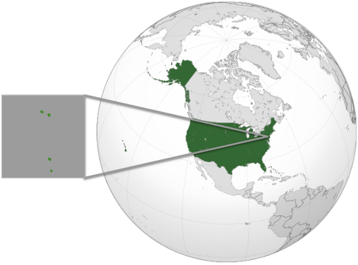
This map shows the claims of the Timonocite Empire. Light green is claimed but uncontrolled, dark green is controlled. The dotted line separates Timo and SEnteral Excitement. This map shows the location in Monmouth County and Middlesex County, New Jersey, United States.
File history
Click on a date/time to view the file as it appeared at that time.
| Date/Time | Thumbnail | Dimensions | User | Comment | |
|---|---|---|---|---|---|
| current | 11:07, 12 December 2022 | | 512 × 379 (119 KB) | Eshaan011 (talk | contribs) | Distinguish between claimed and controlled, added zoomed in part |
| 15:48, 18 September 2020 |  | 512 × 348 (33 KB) | Eshaan011 (talk | contribs) | ||
| 04:16, 25 July 2020 |  | 512 × 557 (128 KB) | Eshaan011 (talk | contribs) |
You cannot overwrite this file.
File usage
The following 3 pages use this file: