File:OSLG Map of Dooneen Cove Island.png
Jump to navigation
Jump to search
Size of this preview: 442 × 600 pixels. Other resolution: 940 × 1,276 pixels.
Original file (940 × 1,276 pixels, file size: 139 KB, MIME type: image/png)
Summary
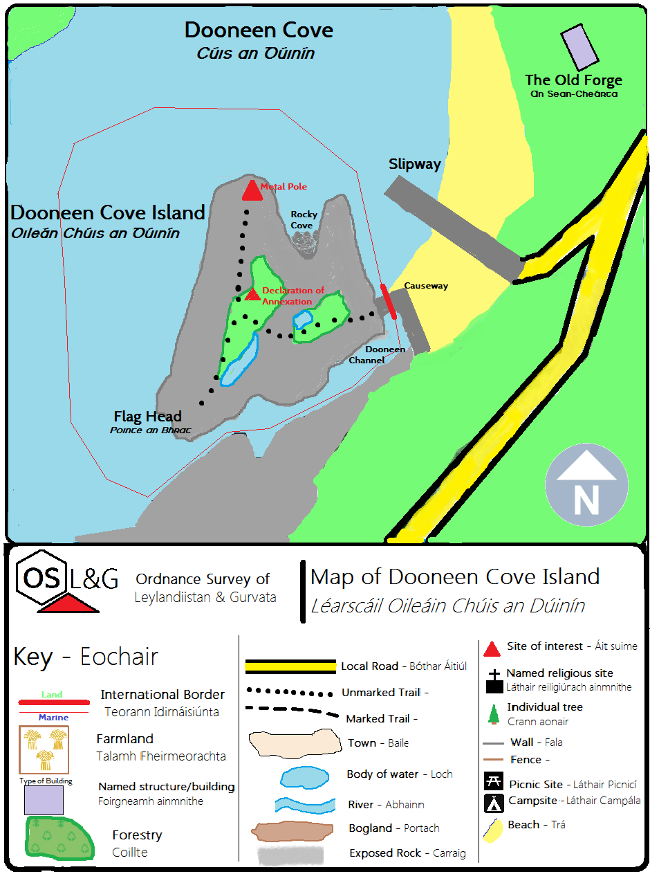
This map is the work of the Ordnance Survey of Leylandiistan & Gurvata, and may only be reproduced with its permission
Licencing
I, the copyright holder of this work, hereby publish it under the following license:
{{{{{1}}}|dw=no|date=|migration= }}
|
File history
Click on a date/time to view the file as it appeared at that time.
| Date/Time | Thumbnail | Dimensions | User | Comment | |
|---|---|---|---|---|---|
| current | 18:47, 8 August 2016 | | 940 × 1,276 (139 KB) | Maintenance script (talk | contribs) | Importing file |
| 14:05, 28 July 2015 | No thumbnail | 940 × 1,276 (139 KB) | Leylandiistan (talk | contribs) | This map is the work of the Ordnance Survey of Leylandiistan & Gurvata, and may only be reproduced with its permission |
You cannot overwrite this file.
File usage
The following page uses this file: