File:Map of the ASSR.png
Jump to navigation
Jump to search
No higher resolution available.
Map_of_the_ASSR.png (250 × 162 pixels, file size: 28 KB, MIME type: image/png)
Summary
| Description |
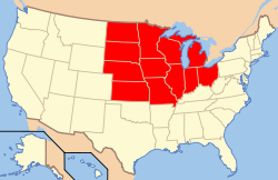
English: Claimed Territory of the ASSR |
|---|---|
| Source |
Own work |
| Date |
2020-10-28 |
| Author | |
| Permission (Reusing this file) |
See below.
|
Licensing
I, the copyright holder of this work, hereby publish it under the following license:
|
File history
Click on a date/time to view the file as it appeared at that time.
| Date/Time | Thumbnail | Dimensions | User | Comment | |
|---|---|---|---|---|---|
| current | 17:18, 28 October 2020 | | 250 × 162 (28 KB) | AIDYN98 (talk | contribs) | User created page with UploadWizard |
You cannot overwrite this file.
File usage
The following page uses this file: