File:Map of Hans Island.png
Jump to navigation
Jump to search

Size of this preview: 800 × 318 pixels. Other resolution: 1,560 × 620 pixels.
Original file (1,560 × 620 pixels, file size: 1.18 MB, MIME type: image/png)
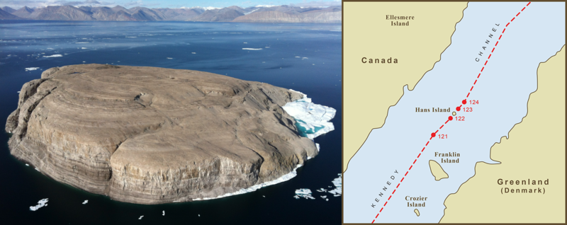
Aerial photograph of Hans Island, with Ellesmere Island seen in the background.
File history
Click on a date/time to view the file as it appeared at that time.
| Date/Time | Thumbnail | Dimensions | User | Comment | |
|---|---|---|---|---|---|
| current | 02:02, 30 October 2020 | 1,560 × 620 (1.18 MB) | VanIsleDominion (talk | contribs) |
You cannot overwrite this file.
File usage
There are no pages that use this file.