File:Map of the Autonomous Province of Silavere.png
(Redirected from File:Federal Republic of Silva Territory.png)
No higher resolution available.
Map_of_the_Autonomous_Province_of_Silavere.png (596 × 363 pixels, file size: 22 KB, MIME type: image/png)
Summary
| Description |
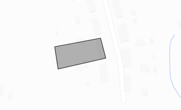
English: This is the current territory of the Autonomous Territory of Silavere |
|---|---|
| Source | No source specified. Please edit this file description and provide a source. |
| Date |
2022-07-09 |
| Author |
Google Satelites |
| Permission (Reusing this file) |
See below.
|
Licensing
| This work is licensed under the Creative Commons Attribution-ShareAlike 4.0 License. |
File history
Click on a date/time to view the file as it appeared at that time.
| Date/Time | Thumbnail | Dimensions | User | Comment | |
|---|---|---|---|---|---|
| current | 14:57, 10 July 2022 | | 596 × 363 (22 KB) | GermanMapping (talk | contribs) | Reverted to version as of 19:25, 9 July 2022 (UTC) |
| 14:51, 10 July 2022 |  | 574 × 257 (18 KB) | GermanMapping (talk | contribs) | This is the territory of the Federal Republic of Silva | |
| 19:25, 9 July 2022 |  | 596 × 363 (22 KB) | GermanMapping (talk | contribs) | Uploaded a work by Google Satelites from https://www.google.com/maps/d/u/0/edit?mid=1XeCjMj2FIMmHuPDX3xG94zl29v9DVfk&ll=51.159169380804805%2C7.201995089286823&z=18 with UploadWizard |
You cannot overwrite this file.
File usage
The following file is a duplicate of this file (more details):
The following 6 pages use this file:
- Autonomous Province of Silavere
- File:Federal Republic of Silva Territory.png (file redirect)
- File:Map of the Autonomous Territory of Silavere.png (file redirect)
- File:Silvanian Socialist Empire.png (file redirect)
- File:Silvanian Socialist Empire Territory.png (file redirect)
- File:Silvanian Union Territory.png (file redirect)