File:Croatia Serbia border Backa Baranja.svg

Original file (SVG file, nominally 520 × 520 pixels, file size: 202 KB)
Summary
| Description |
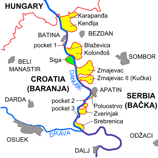
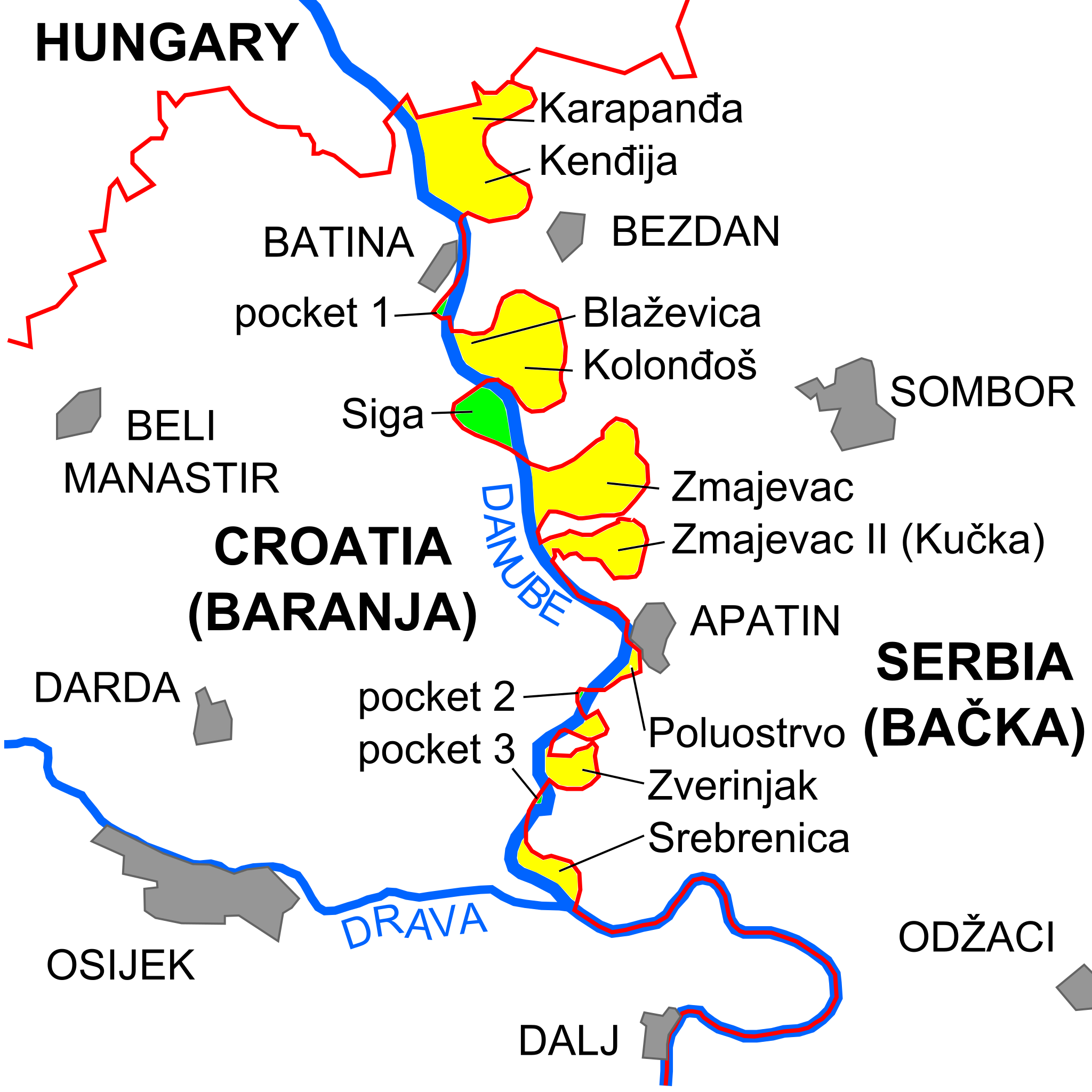
English: Depiction of development of Croatia-Serbia border in Baranja/Bačka area and Croatia-Serbia border dispute in the area (disputed territories marked yellow, indicating Serbian control in April 2014, and green, indicating Croatian control in April 2014). Lines may be approximate. Source: Klemenčić, Mladen; Schofield, Clive H. (2001). War and Peace on the Danube: The Evolution of the Croatia-Serbia Boundary. Durham, England: International Boundaries Research Unit. ISBN 9781897643419, p. 21 |
|---|---|
| Source |
https://en.wikipedia.org/wiki/Terra_nullius#/media/File:Croatia_Serbia_border_Backa_Baranja.svg |
| Date |
2014-04-14 |
| Author |
Tomobe03 |
| Permission (Reusing this file) |
See below.
|
Licensing
| This work is licensed under the Creative Commons Attribution-ShareAlike 3.0 License. |
File history
Click on a date/time to view the file as it appeared at that time.
| Date/Time | Thumbnail | Dimensions | User | Comment | |
|---|---|---|---|---|---|
| current | 14:11, 17 October 2021 | | 520 × 520 (202 KB) | JDFRG (talk | contribs) | Uploaded a work by Tomobe03 from https://en.wikipedia.org/wiki/Terra_nullius#/media/File:Croatia_Serbia_border_Backa_Baranja.svg with UploadWizard |
You cannot overwrite this file.
File usage
The following file is a duplicate of this file (more details):
- File:Croatia Serbia border Backa Baranja.svg from Wikimedia Commons
The following 4 pages use this file: