File:Base map of the Territory.png
Jump to navigation
Jump to search
Size of this preview: 394 × 600 pixels. Other resolution: 1,305 × 1,986 pixels.
Original file (1,305 × 1,986 pixels, file size: 2.42 MB, MIME type: image/png)
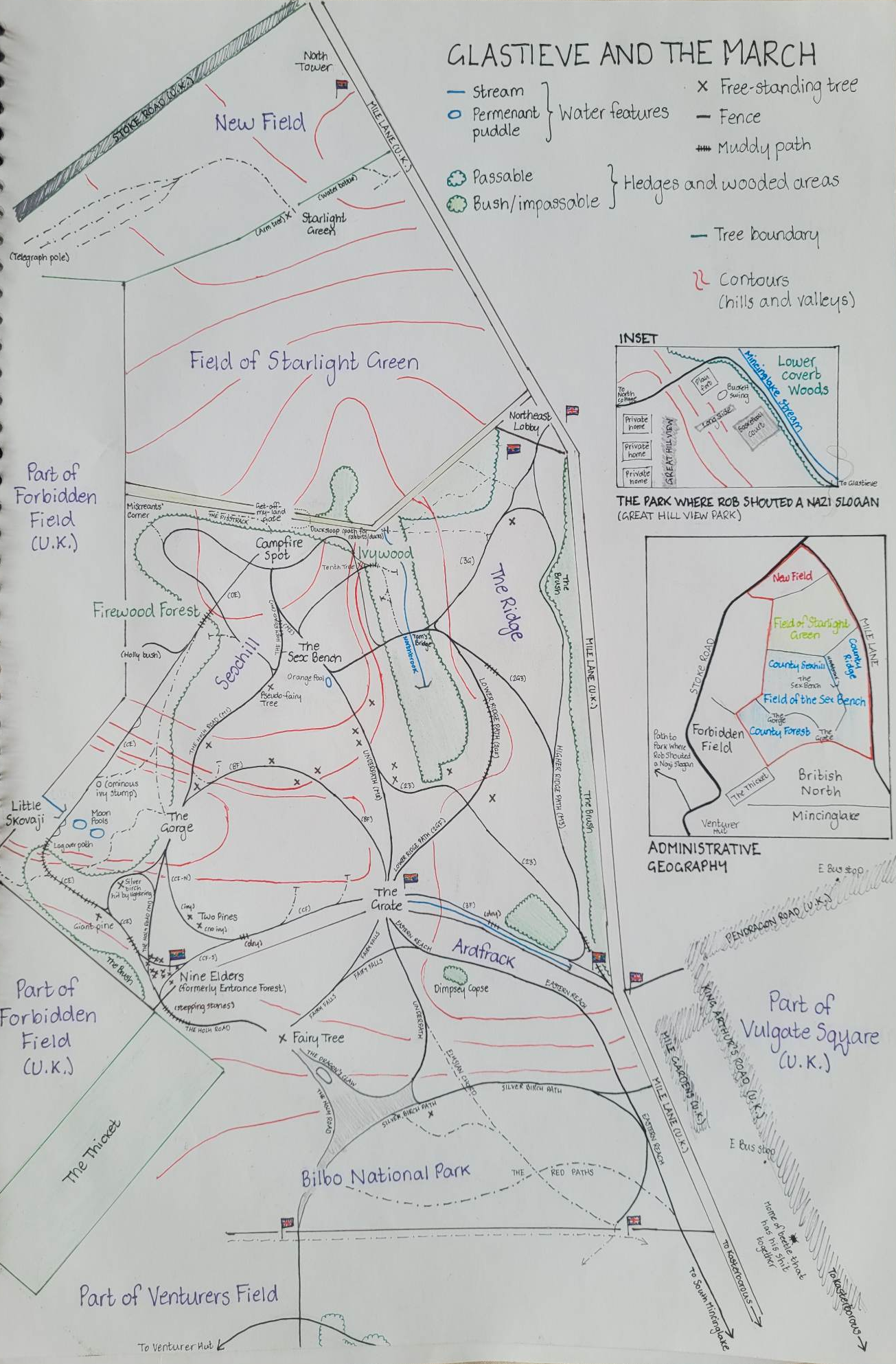
"Base map" (a term of art in Glastieven cartography referring to a map, accepted by the Hallowhouse [university], of the basic layout and "canonical features" of an area) of the sovereign territory of the Holy Glastieven Commonwealth.
File history
Click on a date/time to view the file as it appeared at that time.
| Date/Time | Thumbnail | Dimensions | User | Comment | |
|---|---|---|---|---|---|
| current | 13:58, 15 May 2023 | | 1,305 × 1,986 (2.42 MB) | Lyra of Little Skovaji (talk | contribs) |
You cannot overwrite this file.
File usage
The following page uses this file: