Borders of Navisland
Jump to navigation
Jump to search
This article is of poor quality and may require cleanup to meet MicroWiki's quality standards. Based on the last time it was edited, the future of this article is yet to be determined. Please improve this article if you can; the discussion page may contain suggestions. |
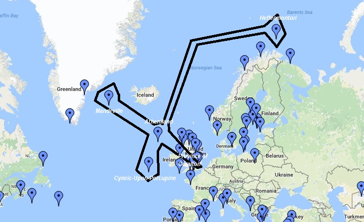
The United States of Navisland border is incredibly confusing without a doubt, as Navisland claims individual shipwrecks all over the world, so some places like Mandeville(capital city) and Heffenmontori are over 200 km away from each other. The first Minister constructed a map of Navisland and all the territory claimed; the entire territory measured 500 km long. That territory is shown below. Names of cities and political divisions listed on the map are:
- Atheniland
- Cymric-Upon-Porcupine
- Heffenmontori
- Mandeville
- Province of Coralton
