File:Map showing location of New Indischeland.gif
Jump to navigation
Jump to search
No higher resolution available.
Map_showing_location_of_New_Indischeland.gif (232 × 149 pixels, file size: 3 KB, MIME type: image/gif)
Summary
| Description |
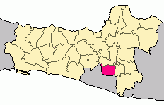
English: Map showing location of New Indischeland |
|---|---|
| Source |
Own work |
| Date |
2022-07-27 |
| Author | |
| Permission (Reusing this file) |
See below.
|
Licensing
I, the copyright holder of this work, hereby publish it under the following license:
|
File history
Click on a date/time to view the file as it appeared at that time.
| Date/Time | Thumbnail | Dimensions | User | Comment | |
|---|---|---|---|---|---|
| current | 09:54, 27 July 2022 | | 232 × 149 (3 KB) | GPF1 (talk | contribs) | Uploaded own work with UploadWizard |
You cannot overwrite this file.
File usage
The following file is a duplicate of this file (more details):
- File:Locator Kabupaten Klaten.gif from Wikimedia Commons
The following page uses this file: