List of micronations by size
Jump to navigation
Jump to search
Note: This is only for real territorial claims, not invented land. Add your nation to the list in order of area, largest first. Area given in square miles. For those unfamiliar with Imperial measurements, 1 square kilometer is roughly equal to 0.386 square miles. Note that not all territories are charted correctly on the list, so please do your best to place your nation in the right spot.
| Name of nation | Area | Location | Remarks | Map |
|---|---|---|---|---|
| 9,000,000 km2 3,500,000 sq mi |
Earth Claims, a Mars Colony, Pluton North Hemisfere and Verden (False Planet). | Australian, New Zealand, American and Canada claims. | 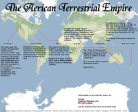
| |
Aiyeiji Federation |
3,198,088.18 km2 1,234,788.75 sq mi |
Earth only Claims. | American, and British Claims, Abyei Claims, Somalian (and Socotran) Claims (East Somalia and Socotran Colonial Union,) along with Antarctic claims (not counted for land here), and Canadian-Michiganian Claims. | 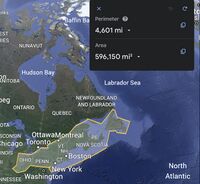 Map of the Mainland  Map of Abyei |
| 2,266,426.67 km2 875,072.23 sq mi |
Lincoln, Nebraska, United States and Antarctic claims. | Map of recognised land claims in Antarctica including New Potato Land. | 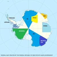
| |
| *Union of Soviet Antarctican Republics | 2,167,987.42 km²
837,092.13 sq mi |
Antarctic Claims between URA, Hortania, Voldenstein,Ruthenia and MOCC | ||
| 1,600,000 km2 620,000 sq mi |
Antarctic claims. | Marie Byrd Land. | 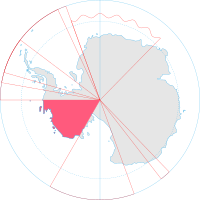
| |
| Papal States 12,003,055 km2 4,634,405 sq mi Polis 13,120.001 km2 5,065.661 sq mi |
Papal States: Some of Colorado and New Mexico some of Africa. Polis: A quarter of America and some of Africa. |
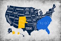 Papal States 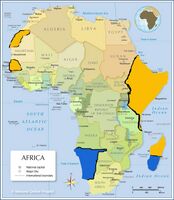 Polis | ||
| Japireus Nation | 898,931.01 km2 347,079.20 sq mi |
Antarctic claims, small sections of Ireland, Southern shore of Lough Neagh in Northern Ireland, pockets around Tokyo, sections in Eastern United States. | Collection of territories scattered across various continents intent on honouring old traditions. | |
| 725,000 km2 280,000 sq mi |
Area claims in Portugal, Britain, Australia and Antarctica. | Map of claims of Eintrachtia, its royal dependencies and protectorates. | 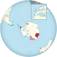
| |
| Usian Republic | 622,420 km2 240,320 sq mi |
Bir Tawil, Africa; Marie-Byrd-Land, Antarctica; Various other territories. | ||
| Kingdom of Lakthia | 458,509 km2 177,031 sq mi |
Subantarctic islands, Terre Adélie, Scattered islands and Geyser bank. | Thousands of islands in the Austral Ocean Aera. | |
| Yellow Klyn | 351,760 km2 135,820 sq mi |
Lower Volga regions and Orenburg districts | 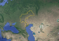 Lands of Yellow Klyn in Europe and Asia | |
| Jungle Island | 227,000 km2 88,000 sq mi |
Taiwan, Falkland Islands, and all of the islands. | 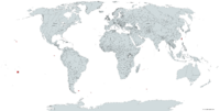
|
|
| Federal Kingdom of Zukeland | 130,000 km2 50,000 sq mi |
Antarctic Peninsula, Ellsworth Land, South Shetland Islands, South Orkney Islands, and minor outlying islands and territories. | Maintains territory in four continents, although the vast majority is within Antarctica. | |
| Republic of Frankoslavia | 123,740 km2 47,780 sq mi |
Hungary and some of the Balkans. | Territory in Hungary, Slovenia, Croatia, Bosnia, and Serbia. | 
|
| Cristor | 114,263 km2 44,117 sq mi |
United States. | ||
| Empire of Finnistan | 102,007.87 km2 39,385.46 sq mi |
(In order of size) Maine, New York, England, Scotland | Largest territory in Maine makes up over 99% of landmass. | |
| Republic of IKwaZulu-Natali | 94,361 km2 36,433 sq mi |
East of South Africa. | 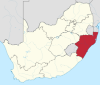
| |
| Imperial Grand Duchy of Renmarchesia | 62,039.85 km2 23,953.72 sq mi |
Austria, Slovenia, Croatia. | 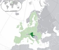
| |
| Woodland Patchwork | 41,440 km2 16,000 sq mi |
Japan | Woodland Patchwork within Japan - Territory marked in Red, Orange and Yellow (7 Territories, 1 Capital). | 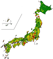
|
| Aleutian Islands | 36,560 km2 14,120 sq mi |
Aleutian West Census Area, and Unimak Island | Provinces and territories of the Aleutian Islands. | 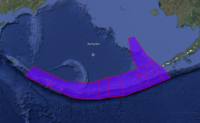
|
| New Taiwan | 36,193 km2 13,974 sq mi |
Formosa (Taiwan) | 
| |
| Kingdom of Sycamore | 34,958 km2 13,497 sq mi |
Continent of Australia. | 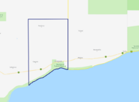
| |
| Republic of Nye | 29,517.7 km2 11,396.8 sq mi |
Nevada, California and Wisconsin. |  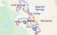 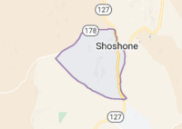
| |
| Kingdom of Sorrenia | 28,000 km2 11,000 sq mi |
Northern England | Divided into 19 counties which collectively make up all of Northern England. | 
|
| 25,142.4 km2 9,707.5 sq mi |
Anarctica, Danube river | Including Antarctic claims which are not usually included in Amicatierra area measurements | ||
| Islamic Republic of Hala'ib Triangle | 20,580 km2 7,950 sq mi |
Hala'ib Triangle. | Disputed and unclaimed area, at the border between Sudan and Egypt. | 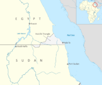
|
| Kingdom of Poulo Wai | 15,625 km2 6,033 sq mi |
Gulf of Thailand. | 2 Islands, 4 Districts. | 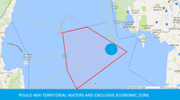
|
| 14,980 km2 5,780 sq mi |
Siple Island, Carney Island, Maher Island, Cherry Island, Pranke Island. | |||
| 13,375.01976 km2 5,164.12400 sq mi |
Metamora, Columbiaville, Houghton Lake, Niger, Canada, Russia, Norway | Small swamps in Michigan, and larger islands around the globe. | 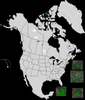
| |
| United Democratic Republic of Mackinac | 5,703 km2 2,202 sq mi |
North America. | 11 Townships, 2 Territories, 1 Capital District (Mackinac Townships act like American states). | 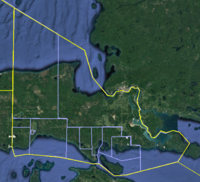
|
| North Jackia | 2,929.76 km2 1,131.19 sq mi |
Scotland, England, Rockall, Kerguelen Islands, Heard Island and McDonald Islands. | Made up of islands. Some of which are still disputed. | 
|
| Republic of Asassin | 2,685 km2 1,037 sq mi |
Bandung, Oecussi-Ambeno, Spratly Island, and other. | 5 States, 7 Dependent Territories, and one territory in Antarctica. | |
| Kingdom of Africa | 2,060 km2 800 sq mi |
Bir Tawil. | Map of the Kingdom of Africa. | 
|
| Free State of Bir Tawil | 2,000 km2 770 sq mi |
Bir Tawil | Map of the United Free State. | 
|
| Republic of Bombardos | 1,678.31 km2 648.00 sq mi |
The Inagua Islands. | Bombardos. | 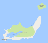
|
| 1,200.38 km2 463.47 sq mi |
Antarctica, Albeau sur Glace. | 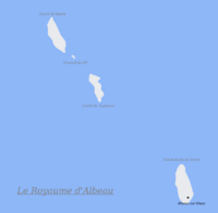
| ||
| Sancti Imperii ex Skywalkistan | 1,069 km2 413 sq mi |
Hillsborough County East of Tampa, Florida. | ||
| 674 km2 260 sq mi |
12 different municipalities of Italy signed an official protocol to offer the land of its territory. | |||
| 574.20 km2 221.70 sq mi |
Beauharnois-Salaberry Regional County Municipality. | Ceremonial territorial claim only. Operational territory is not located in the territorial claim. | 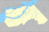
| |
| Democratic Republic of Charles | 368.19 km2 142.16 sq mi |
Jocelyn Islands, Kabile Island, Heard and McDonald Islands. | ||
| 278.5 km2 107.5 sq mi |
16 Territories in New Zealand, 1 in Australia and 1 in the United States | Map of the Territories in New Zealand and Australia and the Map of the Severoamerikansky Territory in the United States | 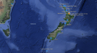 
| |
| Principality of Carnovia | 203 km2 78 sq mi |
Czech Republic. | Map of claimed land of Carnovia. | 
|
| Socialist United Republic of Ünie | 201.32 km2 77.73 sq mi |
Zimbabwe. | ||
| Islamic Emirate of Acre | 196 km2 76 sq mi |
Northern Israel, the Levant. | Claim divided into seven districts located around the Haifa Bay. | 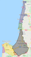
|
| Republic Of Xennistra | 114 km2 44 sq mi |
Between French Polynesia and Cook Islands. | 3 atolls, 4 cities. | 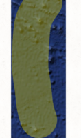
|
| Principality of New Eiffel | 82.761 km2 31.954 sq mi |
Europe. | ||
| Duchy of Batavia | 70 km2 27 sq mi |
Europe. | 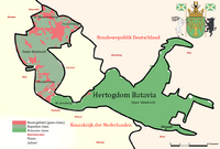
| |
| 41.3 km2 15.9 sq mi |
Greece | Aristino Beach, Constantinople apartements, base in Bulgaria | ||
| 38.6 km2 14.9 sq mi |
North America. | Most is ceremonial with many claims in parks and other public properties. | 
| |
| United States of Akkerman | 36.48 km2 14.09 sq mi |
Belgorod-Dnestrovskiy raion, Odesskaya oblast, Ukraine, Eastern Europe. | 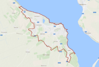
| |
| Republic of Heist-op-den-Berg | 35.65 km2 13.76 sq mi |
Belgium. | 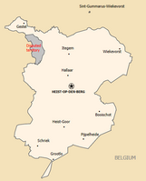
| |
| The Socialist States of Tinakula | 24.4 km2 9.4 sq mi |
Claimed from: UK, Solomon Islands, Papua New Guinea, Australia. | All five regions. | 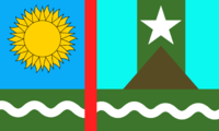
|
| 22.5 km2 8.7 sq mi |
Countries in South America, Mexico, Dominican Republic, Spain and Finland. | 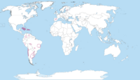
| ||
| 1,180 km2 460 sq mi |
Situated in Italy, about 30 minutes from Rome. | |||
| Kingdom of Prussion | 20.17 km2 7.79 sq mi |
New York City. | Main Territories only, colonies not including if any created in the future. | TBA |
| Free Kingdom of Atomica | 18.1316262 km2 7.0006600 sq mi |
Calagry and Lomand, Alberta, Canada and Winnipeg, Manitoba, Canada. | Divided between five areas. | |
| Grand Duchy of Zakinesia | 17.2km | Philippines | 5 provinces and 2 dependencies | |
| File:Nelson Republic Flag.png Nelson Republic | 13.985 km2 5.400 sq mi |
North Pennsylvania and other territories in Sweden, Finland, and Estonia. | File:Nelson republic.png | |
| 12.94 km2 5.00 sq mi |
North America. | |||
| 11 km2 4.2 sq mi |
Poland. | 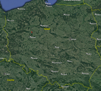
| ||
| 10.936 km2 4.222 sq mi |
Estonia. | 
| ||
| People's Republic of Domolica | 10.31 km2 3.98 sq mi |
United States, Mexico, Belize, and British Virgin Islands. | ||
| Sabah Autonomous community of Taman ria | 7.62 km2 2.94 sq mi |
Penampang. | ||
| Pacificonia | 6.5 km2 2.5 sq mi |
United States and South Pacific. | Two islands and two territories. | |
| 6.15 km2 2.37 sq mi |
Philippines | Arlandica consists of 10 enclaves, 1 exclave, 2 semi-exclaves, and over 40 islands, reefs, and small rocks located throughout various parts of the Philippine archipelago. The country's core territory (Mainland) is located in Davao City. | 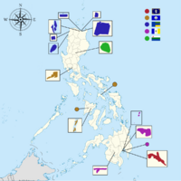
| |
| 5.45 km2 2.10 sq mi |
Sayville, Long Island | |||
| 4.76 km2 1.84 sq mi |
Perth (On Darling Range and north of CBD), near Augusta | Previously measured 10.16 km2, however was reduced in January 2023 to 2.99 km2 and increased in March 2024. Has two international borders and two maritime borders. | 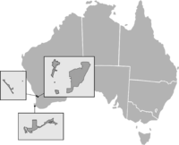
| |
| New Weddington Isles | 3.85 km2 1.49 sq mi |
South Pacific and Indian Ocean. | Formerly the unclaimed Royal Company's Islands (sits outside of any territorial waters). | 
|
| Litvania | 3.47 km2 1.34 sq mi |
Bernex, Switzerland. | ||
| 2.67 km2 1.03 sq mi |
Las Virtudes, Alicante, Spain. | Official map of the Principality of Gumland. | 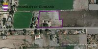
| |
| 2.6 km2 1.0 sq mi |
Badalona, Barcelona, Catalonia, Spain (Capital) Éller, Lleida, Catalonia, Spain Camallera, Girona, Catalonia, Spain ???, ???, ???, UK Athína, ???, ???, Greece. |
All of the territory voluntarily joined the Tsardom (except the capital). | 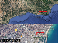
| |
| 2.58 km2 1.00 sq mi |
Brazil and Bolívia borders. | |||
| 2 km2 0.77 sq mi |
Sierra Vista, Arizona. | |||
| Republic of Scoria | 1.97 km2 0.76 sq mi |
Offshore Islands south west of Ireland. | Scoria consists of the two islands of Scariff and Deneesh, located at the far south west of the Island of Ireland. The government resides in an exclave fully surrounded by the Republic of Ireland. | 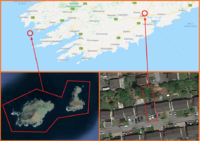
|
| Imperial Grand Duchy of Lundenwic | 1.97 km2 0.76 sq mi |
London, United Kingdom; Torrevieja, Spain; Grímsey, Iceland. | ||
| State of Gradonia | 1.735 km2 0.670 sq mi |
Brazos County, Texas. | ||
| 1.441 km2 0.556 sq mi |
Luzon, NCR, Las Piñas city. | 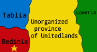
| ||
| 1.12 km2 0.43 sq mi (approximately) |
Spain and Portugal. | MAP] | ||
| Grand Republic of Delvera | 1.08437 km2 0.41868 sq mi |
Missouri and Kansas, United States. | ||
| 1.07 km2 0.41 sq mi |
Perth (Australia), Auckland (New Zealand), Tokyo (Japan), and Hoi An (Vietnam) | |||
| Pitchfork Union | 1.03 km2 0.40 sq mi |
On the border of German and Perry Township, Evansville, Indiana. | ||
| Principality of Andany | 1.02 km2 0.39 sq mi |
On the northeastern tip of Sardinina, Italy. | 
| |
| Royal Republic of Ladonia | 1 km2 0.39 sq mi |
On the Kullaberg Peninsula in Southern Sweden. | ||
| 1 km2 0.39 sq mi |
Malaysia, Kedah. | 1 Capital and 10 States. | 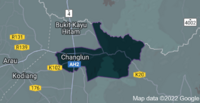
| |
| Kingdom of Mivland | 0.97 km2 0.37 sq mi |
Missouri, United States. | ||
| 0.825 km2 0.319 sq mi |
Spain claims. | Map of claim zones. | 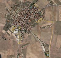
| |
| Kingdom of Efransa | 0.58 km2 0.22 sq mi |
New York. | Map of the Location of Metropolitan Efransa within New York State. | 
|
| 0.4696 km2 0.1813 sq mi |
Sydney, Australia's North Shore region. | Preceded by Australland. | 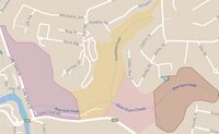
| |
| 0.4091 km2 0.1580 sq mi |
Various spots on Sydney's North Shore, particularly the border between Willoughby City Council and Ku Ring Gai Council. | Succeeded by Onopolissia. | Link to map | |
| Harmonia | 0.38 km2 0.15 sq mi |
Johor,Malaysia. | ||
| Conservationist Union of Vivannia | 0.3237 km2 0.1250 sq mi |
|||
| 0.3 km2 0.12 sq mi |
Åland. | One of the only micronations on Åland | 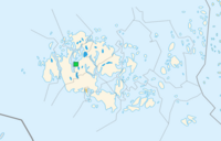
| |
| Kingdom of Baustralia | 0.270001080526 km2 0.104248000000 sq mi |
Canada. | ||
| 0.221 km2 0.085 sq mi |
Bosnia and Herzegovina and Norway | Two regions and 13 colonies in Bosnia and Herzegovina and one colony in Norway | 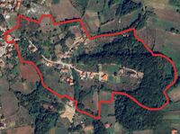
| |
| 0.214 km2 0.083 sq mi |
Netherlands. | One of the sections of the neighbourhood, some random small patches of grass, water and a house. | 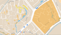 Northern claims 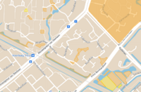 Southern claims | |
| 0.2029877836 km2 0.0783740214 sq mi |
Massachusetts, United States. South Georgia and the South Sandwich Islands. |
5 occupied territories. | 
| |
| Empire of Austenasia | 0.16261 km2 0.06278 sq mi |
Great Britain, South America, Australasia | ||
| 0.135719 km2 0.052401 sq mi |
Pakistan. | Has two provinces, one in Bannu, Khyber Pakhtunkhwa (Faniiland) and the other in Lahore, Punjab (New Navynesia). | ||
| 0.13 km2 0.050 sq mi |
South Prague, Czech Republic. | |||
| Republic of Danielland | 0.126562 km2 0.048866 sq mi |
Inside State of Georgia, island off coast of Antarctica, islands in Gulf of Alaska. | 
| |
| 0.1233 km2 0.0476 sq mi |
North America. | |||
| 0.116 km2 0.045 sq mi |
Northeasten Iberian Peninsula. | 
| ||
| Holy Kingdom of Deseret | 0.11185 km2 0.04319 sq mi |
Wasatch County, Utah. | ||
| Freetown Christiana | 0.07 km2 0.027 sq mi |
Denmark Claims. | Christiana, Copenhagen, Denmark. | |
| 0.063 km2 0.024 sq mi |
Virginian Claims. | Brodnax, Chesterfield, Petersburg | 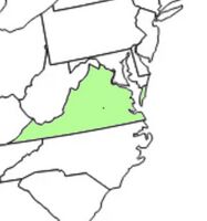
| |
| Republic of Novaland | 0.06 km2 0.023 sq mi |
Bretagne, France, Asia. | ||
| Humanytaria | 0.057 km2 0.022 sq mi |
Kopački Rit, Croatia and two small embassies (United Kingdom). | ||
| Dictatorship of Craoria | 0.0566 km2 0.0219 sq mi |
South Park, Lawrence, Kansas. | ||
| Republic of the 43rd | 0.0517 km2 0.0200 sq mi |
Marie Curtis And Forest parks, Mississauga (Canada). | ||
| 0.05 km2 0.019 sq mi |
London, England. | |||
| Isles of Colibar | 0.043 km2 0.017 sq mi |
Portsmouth, United Kingdom. | ||
| Kingdom of Florenia | 0.04219 km2 0.01629 sq mi |
North America. | ||
| Kingdom of Tsurasia | 0.0341 km2 0.0132 sq mi |
Blackey, Kentucky, United States. | 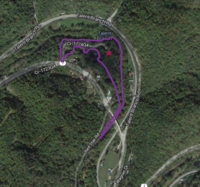
| |
| Star Kingdom | 0.03333 km2 0.01287 sq mi |
Macon, Georgia, United States. | ||
| Empire of Adammia | 0.03254 km2 0.01256 sq mi |
Yorkshire, Cheshire and Devon, United Kingdom. | Featured maps of Primoria and Maternia, approximately 300 square metres shown. | |
| 0.027 km2 0.010 sq mi |
Söderhamn Municipality, Gävleborg County, Sweden. | 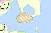
| ||
| Steve™ Kingdom | 0.0259 km2 0.0100 sq mi |
Jõelähtme vald, Harjumaa; Kose vald, Harjumaa; Vinni vald, Lääne-Virumaa, Estonia. | ||
| Republic of Molossia | 0.02234 km2 0.00863 sq mi |
Nevada. | 
| |
| Libria | 0.0208333 km2 0.0080438 sq mi |
Kennesaw, Georgia. | ||
| Republic of Ondia | 0.0205189 km2 0.0079224 sq mi |
Bánovce nad Bebravou, Slovakia. | TBA | |
| Republic of Patetopia | 0.01288 km2 0.00497 sq mi |
United States. | ||
| 0.01214 km2 0.00469 sq mi |
United States. | Fort Wayne, Indiana, United States. | ||
| 0.010097 km2 0.003898 sq mi |
Lekeberg Municipality, Örebro County, Sweden. | 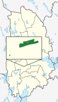
| ||
| 0.00781 km2 0.00302 sq mi |
Southwest North Carolina. | |||
| Kingdom of Überstadt | 0.005 km2 0.0019 sq mi |
Mountlake Terrace, Washington, United States. | ||
| Blue Army | 0.004349602273 km2 0.001679390826 sq mi |
International. | The size noted here does not include any micro proxies under the Blue army. | |
| Democratic Environmental Society of Senya | 0.0036 km2 0.0014 sq mi |
The back of a garden in Norfolk, United Kingdom. | ||
| Kingdom of Atovia | 0.02 km2 0.0077 sq mi |
Ohio, United States. | 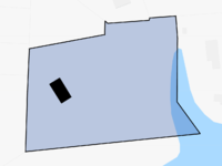
| |
| Gymnasium State | 0.0078 km2 0.0030 sq mi |
Gymnasium in Sušice, Czech Republic. | 
| |
| Kingdom of Wyvern | 0.00296 km2 0.00114 sq mi |
South Holland, the Netherlands. | 7592m2 | |
| Yusienia | 0.00156 km2 0.00060 sq mi |
Attica, Greece. | De facto control zone. | |
| 0.001247 km2 0.000481 sq mi |
House in Žatec, Czech Republic. | |||
| The Kingdom of Falcar | 0.00112 km2 0.00043 sq mi |
South Australia. | 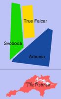
| |
| 0.0009229 km2 0.0003563 sq mi |
Australia, New South Wales, Bathurst. | |||
| Kingdom of Caeruleus | 0.0008 km2 0.00031 sq mi |
United States. | ||
| Unified Kingdom of Slimesylvania | 0.0004965274 km2 0.0001917103 sq mi |
Texas, United States. | ||
| Potato | 0.0004236379 km2 0.0001635675 sq mi |
Pennsylvania, United States. | The land area in square feet is 4,560 sq feet. It is 76 feet by 60 feet. | 
|
| 0.000423 km2 0.000163 sq mi |
Valais, Switzerland. | 
| ||
| Garden Republic of Sirland | 0.00026 km2 0.00010 sq mi |
Mecklenburg-Vorpommern Germany. | 
| |
| Kingdom of Wattania | 0.0002 km2 7.7×10⁻⁵ sq mi |
Victoria, Australia. | Estimated. | 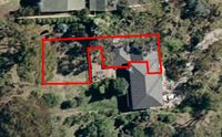
|
| Empire of Myrotania | 0.00016 km2 6.2×10⁻⁵ sq mi |
Britain. | 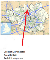
| |
| 0.00010 km2 3.9×10⁻⁵ sq mi |
Capital. | |||
| The Greater Parliamentary Republic of Remland | 0.000087 km2 3.4×10⁻⁵ sq mi |
United States. | ||
| Empire of Barbettia | 0.0000494289 km2 1.90846×10⁻⁵ sq mi |
North America. | ||
| British Empire | 0.0000274406 km2 1.05949×10⁻⁵ sq mi |
United Kingdom. | ||
| 0.000017 km2 6.6×10⁻⁶ sq mi |
New York City. | |||
| 0.000013 km2 5.0×10⁻⁶ sq mi |
Three rooms in Toronto, Ontario, Canada. | |||
| 0.0000120 km2 4.6×10⁻⁶ sq mi |
Rio Grande do Norte. | |||
| United States of Georgia | 0.000004103 km2 1.584×10⁻⁶ sq mi |
A bedroom in a house. | ||
| Kingdom of Sollena | 0.00001 km2 3.9×10⁻⁶ sq mi |
Mihail Kogalniceanu village, Tulcea County, Romania. | 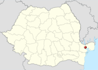
| |
| 0.000005657 km2 2.184×10⁻⁶ sq mi |
Puerto Rico, America. | Claims 9.103 km2 | 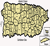
| |
| Union of Wasteoftimeistan | 0.00000176 km2 6.8×10⁻⁷ sq mi |
A table in an art room, Bishop of Llandaff, Wales, United Kingdom. | ||
| 0.000001 km2 3.9×10⁻⁷ sq mi |
Located in the Arstotzkan Union Proper, in New Zealand. | It is one of the only micronations in New Zealand to not have a border with New Zealand. | ||
| Serra Nova | 0.212 km2 0.082 sq mi |
Located in Loven Park, Sofia, Bulgaria | It is one of the first micronations in Sofia, Bulgaria. |
